Tập tin:Avebury World Heritage Site map.svg

Kích thước bản xem trước PNG này của tập tin SVG: 679×599 điểm ảnh. Độ phân giải khác: 272×240 điểm ảnh | 544×480 điểm ảnh | 870×768 điểm ảnh | 1.160×1.024 điểm ảnh | 2.320×2.048 điểm ảnh | 1.614×1.425 điểm ảnh.
Tập tin gốc (tập tin SVG, 1.614×1.425 điểm ảnh trên danh nghĩa, kích thước: 904 kB)
Tập tin này từ Wikimedia Commons. Trang miêu tả nó ở đấy được sao chép dưới đây. Commons là kho lưu trữ tập tin phương tiện có giấy phép tự do. Bạn có thể tham gia. |
Miêu tả
| Miêu tả |
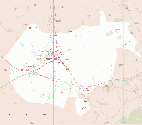
English: Boundary and key sites on the Avebury section of the Stonehenge, Avebury and Associated Sites World Heritage Site |
| Ngày | |
| Nguồn gốc | OS Open Data with additional material cited at World Heritage Site list No 373 |
| Tác giả | RobinLeicester building on OS OpenData VextorMap District Raster files |
| Vị trí máy chụp hình | | Xem hình này và các hình ảnh lân cận trên: OpenStreetMap |
|---|
Giấy phép
This file is licensed by the Ordnance Survey of the United Kingdom under their OS OpenData License
In short: you are free to distribute and modify the file as long as you attribute (including year), the Ordnance Survey. Ghi công: Contains Ordnance Survey data © Crown copyright and database right (year) Note: Derivative works can be licensed under any Creative Commons Attribution 3.0 Licence. |
_(St_Edwards_Crown).svg)
|
This file is licensed under the United Kingdom Open Government Licence v3.0. |
See also: Meta for information on usage on Wikimedia wikis.
|
Lịch sử tập tin
Nhấn vào ngày/giờ để xem nội dung tập tin tại thời điểm đó.
| Ngày/giờ | Hình xem trước | Kích cỡ | Thành viên | Miêu tả | |
|---|---|---|---|---|---|
| hiện tại | 01:14, ngày 28 tháng 12 năm 2014 | | 1.614×1.425 (904 kB) | RobinLeicester | User created page with UploadWizard |
Trang sử dụng tập tin
Có 1 trang tại Wikipedia tiếng Việt có liên kết đến tập tin (không hiển thị trang ở các dự án khác):
Sử dụng tập tin toàn cục
Những wiki sau đang sử dụng tập tin này:
- Trang sử dụng tại en.wikipedia.org
- Trang sử dụng tại fi.wikipedia.org
- Trang sử dụng tại fr.wikipedia.org
- Trang sử dụng tại ja.wikipedia.org
- Trang sử dụng tại kw.wikipedia.org
- Trang sử dụng tại nl.wikipedia.org
- Trang sử dụng tại simple.wikipedia.org
- Trang sử dụng tại sl.wikipedia.org