Tập tin:Fernão Vaz Dourado 1571-1.jpg
Tập tin gốc (3.102×2.381 điểm ảnh, kích thước tập tin: 5,82 MB, kiểu MIME: image/jpeg)
Tập tin này từ Wikimedia Commons. Trang miêu tả nó ở đấy được sao chép dưới đây. Commons là kho lưu trữ tập tin phương tiện có giấy phép tự do. Bạn có thể tham gia. |
|
Bức hình này đã được chọn làm hình ảnh của ngày trên Wikimedia Commons vào ngày 18 tháng 7 năm 2008. Dưới đây là lời mô tả: Các ngôn ngữ khác:
Bosanski: Zapadna Afrika na nautičkoj karti portugalskog kartografa Fernão-a Vaz Dourado-a, 1571. Čeština: Západní Afrika na mapě portugalského kartografa Fernão Vaz Dourado z roku 1571. Dansk: Vestafrika på et søkort af den portugisiske kartograf Fernão Vaz Dourado, 1571. Deutsch: Nautische Karte von Westafrika, gezeichnet 1571 vom portugiesischen Kartographen Fernão Vaz Dourado. Français : Carte nautique de Fernão Vaz Dourado (c. 1520 - c. 1580), extraite d'un atlas nautique tracé en 1571 et conservé dans les Archives Nationales Portugaises de Torre do Tombo, à Lisbonne. Íslenska: Vestur-Afríka á sjókorti eftir portúgalska kortagerðarmanninn Fernão Vaz Dourado frá 1571. Italiano: L'Africa occidentale in una carta nautica del cartografo portoghese Fernão Vaz Dourado, 1571. Magyar: Nyugat-Afrika portolántérképe, Fernão Vaz Dourado portugál térképész munkája (1571). A térkép egy tengerészeti atlaszhoz tartozott, jelenleg a Portugál Nemzeti Archívumban őrzik. Português: Uma carta náutica de Fernão Vaz Dourado, da África ocidental extraída do atlas náutico de 1571, pertencente ao Arquivo Nacional da Torre do Tombo, em Lisboa. Română: Hartă de navigație realizată de cartograful portughez Fernão Vaz Douradoî reprezentând regiunea Africii de vest. Svenska: Sjökort över Västafrikas kust, ritat av den portugisiske kartografen Fernão Vaz Dourado 1571. Беларуская: Заходняя Афрыка на марской карце партугальскага картографа Фернана Вас-Дурада (1571). Українська: Морська мапа Західної Африки португальського картографа Фернао Ваш Дораду (Fernão Vaz Dourado), 1571. मराठी: पश्चिमी अफ्रीका नकाशा, एक समुद्री पुर्तगाली मानचित्रकार फर्नॅव वाज डोराडो, इ.स. १५७१. 한국어: 포르투갈 지도 제작자 페르낭 바즈 도우라도가 1571년에 그린 서아프리카 해도. 中文: 费尔南·瓦斯·多拉多于1571年绘制的西非航海图 |
Miêu tả
| Lời miêu tả |
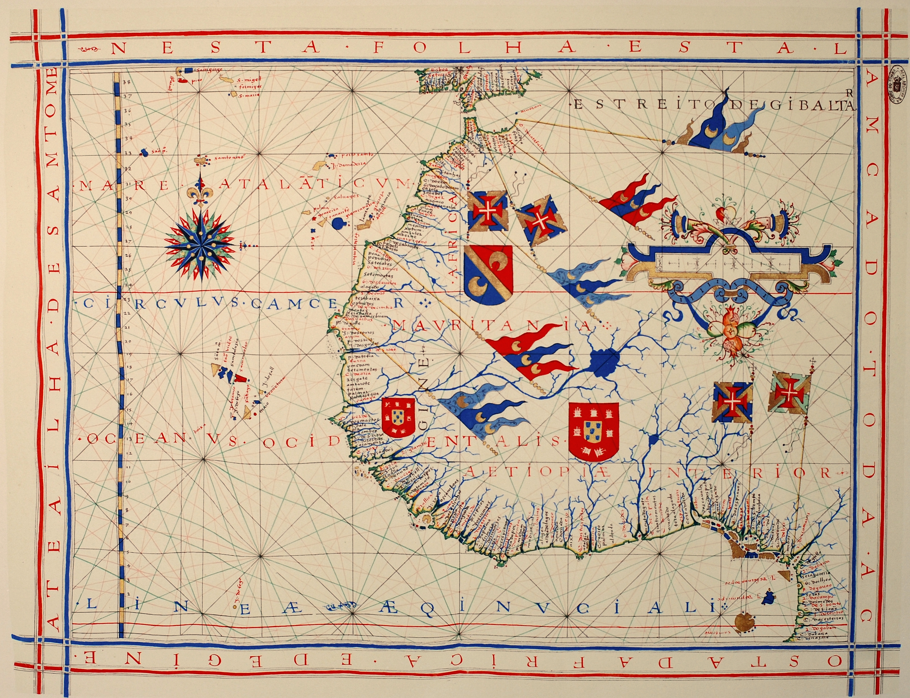
Português: Carta náutica de Fernão Vaz Dourado (c. 1520 - c. 1580), integrante de um atlas desenhado em 1571, atualmente no Arquivo Nacional da Torre do Tombo (ANTT) em Lisboa.
Deutsch: Westafrika, hier genannt Aetiopiae Interior. Seekarte aus einem Atlas von 1571 des portugiesischen Kartographen Fernão Vaz Dourado (ca. 1520 - ca. 1580). Nationalarchiv Torre do Tombo (ANTT) in Lissabon.
Nederlands: West-Afrika, hier genoemd Aetiopiae Interior. Zeekaart uit een atlas van 1571 van de Portugese cartograaf Fernão Vaz Dourado (ca. 1520 - ca. 1580). Nationaal archief Torre do Tombo (ANTT) in Lissabon.
English: Nautical chart of Portuguese cartographer Fernão Vaz Dourado (c. 1520 - c. 1580), part of a nautical atlas drawn in 1571 and now kept in the Portuguese National Archives of Torre do Tombo (ANTT), Lisbon.
Français : Carte nautique de Fernão Vaz Dourado (c. 1520 - c. 1580), extraite d'un atlas nautique tracé en 1571 et conservé dans les Archives Nationales Portugaises de Torre do Tombo (ANTT), à Lisbone. |
|||||||||
| Ngày | Original work of 1571. Photo taken in 2008 | |||||||||
| Nguồn gốc | Tác phẩm được tạo bởi người tải lên | |||||||||
| Sáng tác | ||||||||||
| Geotemporal data | ||||||||||
| Bounding box |
|
|||||||||
| Georeferencing | ||||||||||
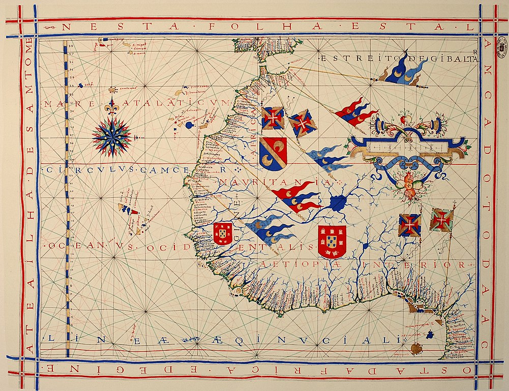
| Phiên bản khác | Derivative works of this file: Map of Arguin Bay, 1571 (detail).jpg | |||||||||
.jpg)
Giấy phép
|
Tác phẩm này thuộc về phạm vi công cộng tại quốc gia gốc và các quốc gia và vùng lãnh thổ có thời hạn bản quyền là cuộc đời tác giả cộng thêm 70 trở xuống.
| |
| Tập tin này đã được đánh dấu là không bị hạn chế dưới luật bản quyền, kể cả tất cả những quyền liên quan và lần cận. | |
Lịch sử tập tin
Nhấn vào ngày/giờ để xem nội dung tập tin tại thời điểm đó.
| Ngày/giờ | Hình xem trước | Kích cỡ | Thành viên | Miêu tả | |
|---|---|---|---|---|---|
| hiện tại | 15:16, ngày 25 tháng 1 năm 2013 | | 3.102×2.381 (5,82 MB) | Slick-o-bot | Bot: convert to a non-interlaced jpeg (see bug #17645) |
| 14:42, ngày 6 tháng 3 năm 2008 |  | 3.102×2.381 (5,32 MB) | Alvesgaspar | {{Information |Description= |Source= |Date= |Author= |Permission= |other_versions= }} | |
| 09:53, ngày 6 tháng 3 năm 2008 |  | 3.079×2.349 (4,53 MB) | Alvesgaspar | {{Information |Description=Nautical chart of Portuguese cartographer Fernão Vaz Dourado (c. 1520 - c. 1580), part of a nautical atlas drawn in 1571 and now kept in the Portuguese National Archives of Torre do Tombo, Lisbon. |Source=self-made |Date=Origin |
Trang sử dụng tập tin
Sử dụng tập tin toàn cục
Những wiki sau đang sử dụng tập tin này:
- Trang sử dụng tại af.wikipedia.org
- Trang sử dụng tại ar.wikipedia.org
- Trang sử dụng tại bn.wikipedia.org
- Trang sử dụng tại ca.wikipedia.org
- Trang sử dụng tại crh.wikipedia.org
- Trang sử dụng tại cv.wikipedia.org
- Trang sử dụng tại de.wikipedia.org
- Trang sử dụng tại el.wikipedia.org
- Trang sử dụng tại en.wikipedia.org
- Cartography
- History of Portugal (1415–1578)
- Nautical chart
- Conquistador
- Portal:Africa
- Portal:Africa/Featured picture
- Portal:Geography
- European exploration of Africa
- Portal talk:Africa/Featured picture
- User:Alvesgaspar
- Portal:Maps/Selected picture
- Wikipedia:Featured pictures thumbs/11
- Wikipedia:Featured picture candidates/March-2008
- Fernão Vaz Dourado
- Wikipedia:Featured picture candidates/Fernão Vaz Dourado nautical chart
- Wikipedia:Wikipedia Signpost/2008-03-17/Features and admins
- Portal:Africa/Featured picture/23
- Wikipedia:Featured pictures/Diagrams, drawings, and maps/Maps
- Wikipedia:Picture of the day/September 2008
- Wikipedia:Wikipedia Signpost/2008-03-17/SPV
- Template:POTD/2008-09-27
- Portal:Maps/Selected picture/36
- User:Peter Mercator/Draft for Mercator
- Battle of Guinea
- User talk:Alvesgaspar/archive1
- Iberian cartography, 1400–1600
- Portal:Geography/Selected picture
- Portuguese nautical science
- Portal:Geodesy
- Wikipedia:Wikipedia Signpost/Single/2008-03-17
- Trang sử dụng tại es.wikipedia.org
- Trang sử dụng tại eu.wikipedia.org
- Trang sử dụng tại fa.wikipedia.org
- Trang sử dụng tại fr.wikipedia.org
- Trang sử dụng tại he.wikipedia.org
Xem thêm các trang toàn cục sử dụng tập tin này.