Tập tin:PIA20014-Ceres-SurveyAtlas-Overall-June2015.jpg

Tập tin gốc (874×477 điểm ảnh, kích thước tập tin: 90 kB, kiểu MIME: image/jpeg)
Tập tin này từ Wikimedia Commons. Trang miêu tả nó ở đấy được sao chép dưới đây. Commons là kho lưu trữ tập tin phương tiện có giấy phép tự do. Bạn có thể tham gia. |
Miêu tả
| Miêu tả |
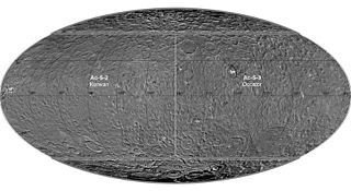
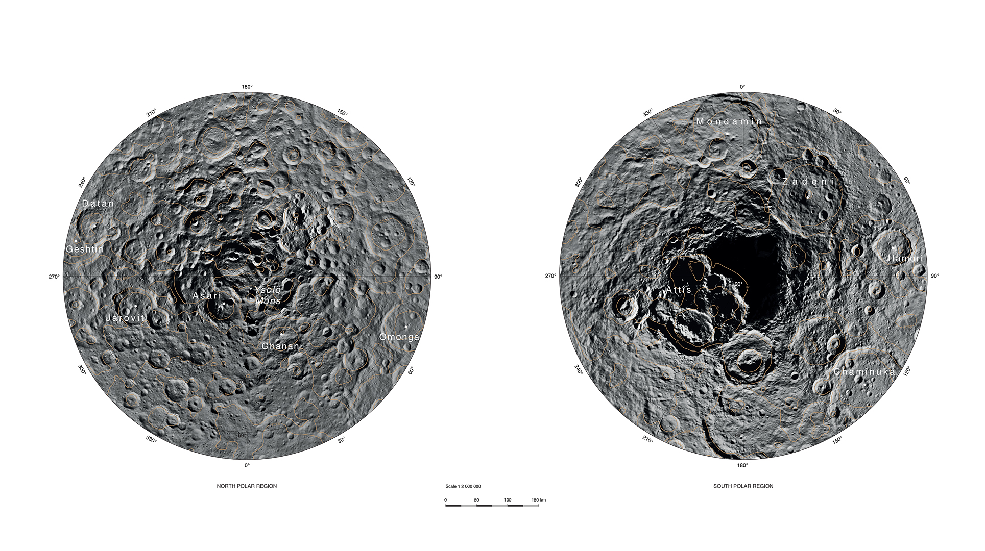
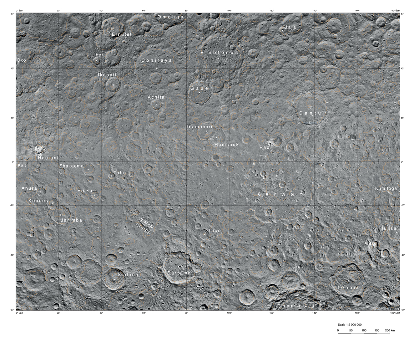
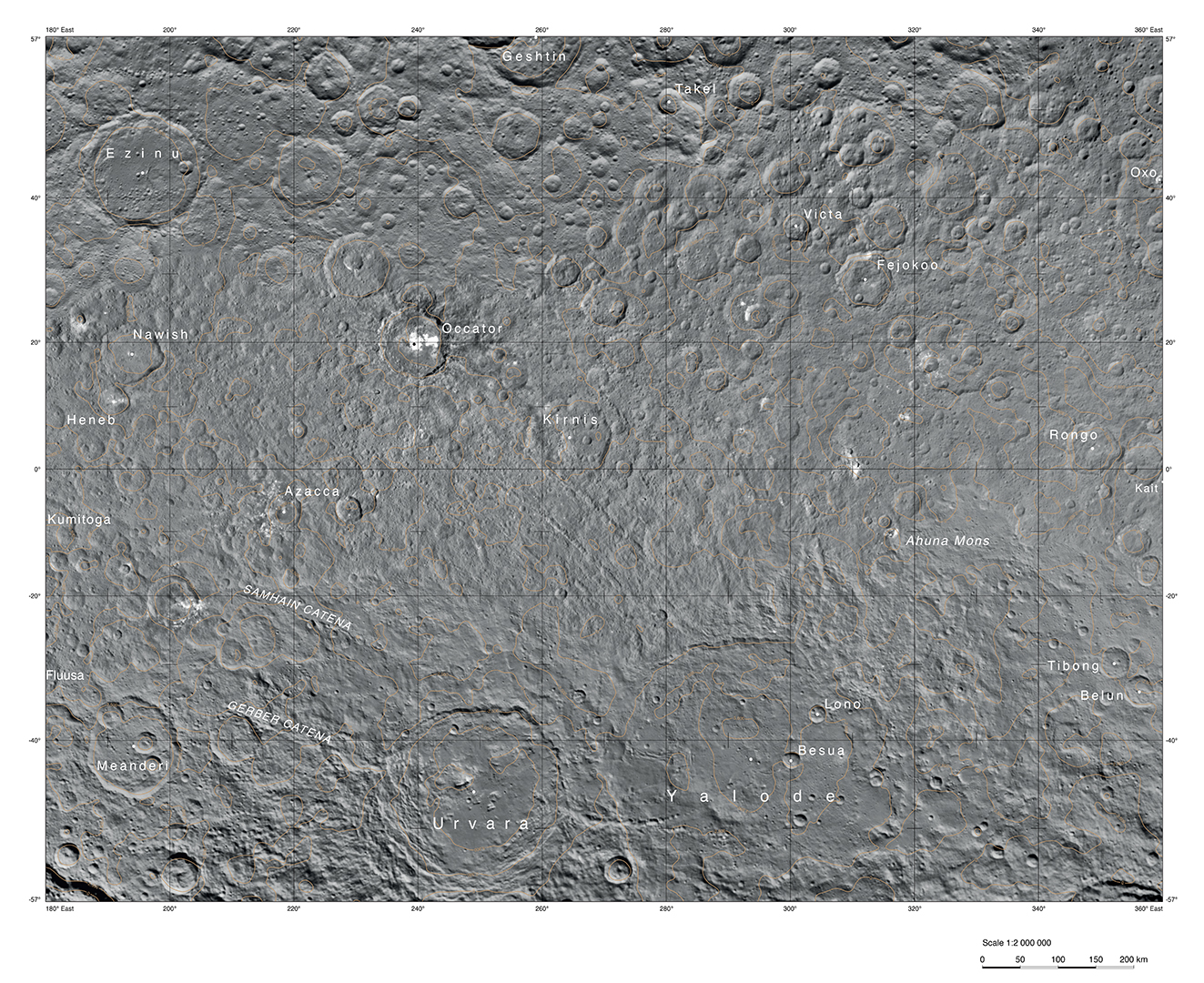
English: PIA20014: Ceres Survey Atlas - June 2015
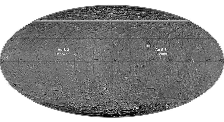
http://photojournal.jpl.nasa.gov/catalog/PIA20014 This atlas of Ceres was created using images taken by NASA's Dawn spacecraft in June 2015. Researchers used 12,000 points on Ceres to construct a terrain model, which served as the basis for these maps. Kait crater was chosen as the reference point for longitude 0. The German Aerospace Center (DLR) constructed this atlas using data from Dawn's Survey orbit, when the spacecraft was at an altitude of about 2,700 miles (4,400 kilometers) above Ceres. The resolution is approximately 1,400 feet (410 meters) per pixel in the full-resolution PDF. The Kerwan map section is centered on 0 degrees latitude, 90 east longitude. The Occator map section is centered on 0 degrees latitude, 270 east longitude. The Asari-Zadeni map section is centered above Ceres' north and south polar regions.
|
| Ngày | |
| Nguồn gốc | http://photojournal.jpl.nasa.gov/jpeg/PIA20014.jpg |
| Tác giả | NASA/JPL-Caltech/UCLA/MPS/DLR/IDA |
Giấy phép
| This file is in the public domain in the United States because it was solely created by NASA. NASA copyright policy states that "NASA material is not protected by copyright unless noted". (See Template:PD-USGov, NASA copyright policy page or JPL Image Use Policy.) | ||
 |
Warnings:
|
Lịch sử tập tin
Nhấn vào ngày/giờ để xem nội dung tập tin tại thời điểm đó.
| Ngày/giờ | Hình xem trước | Kích cỡ | Thành viên | Miêu tả | |
|---|---|---|---|---|---|
| hiện tại | 21:03, ngày 1 tháng 12 năm 2015 | | 874×477 (90 kB) | Drbogdan | User created page with UploadWizard |
Trang sử dụng tập tin
Sử dụng tập tin toàn cục
Những wiki sau đang sử dụng tập tin này:
- Trang sử dụng tại en.wikipedia.org
- Trang sử dụng tại fa.wikipedia.org
- Trang sử dụng tại ja.wikipedia.org
- Trang sử dụng tại kk.wikipedia.org
- Trang sử dụng tại pt.wikipedia.org
- Trang sử dụng tại zh.wikipedia.org