Bản mẫu:Bản đồ định vị nhiều
| Bản mẫu này sử dụng Lua: |
Bản mẫu:Bản đồ định vị nhiều creates a location map as a composite image of an existing map, with multiple markers and optional labels superimposed onto it. This template functions in the style of Bản mẫu:Location_map, but allows multiple markers and labels (rather than just one marker).
For an unlimited list of markers/labels, see: Bản mẫu:Bản đồ định vị+, which specifies points as a coded template list of markers/labels.
Cách sử dụng
sửaThe first unnamed parameter (shown as {{{1}}} below) specifies a map definition. If {{{1}}} is Spain, the map image and coordinates are based on the values defined for Spain in Mô đun:Location map/data/Spain if it exists, or in Bản mẫu:Bản đồ định vị Tây Ban Nha otherwise.
{{Bản đồ định vị nhiều
| {{{1}}}
| width       =
| float       =
| border      =
| caption     =
| alt         =
| relief      =
| AlternativeMap =
| <!--first label/marker-->
| label1      =  <!-- or: label -->
| label1_size =  <!-- or: label_size -->
| position1   =  <!-- or: position, pos1, pos -->
| background1 =  <!-- or: background, bg1, bg -->
| mark1       =  <!-- or: mark -->
| mark1size   =  <!-- or: marksize -->
| link1       =  <!-- or: link -->
| lat1_deg    =  <!-- or: lat_deg -->
| lat1_min    =  <!-- or: lat_min -->
| lat1_sec    =  <!-- or: lat_sec -->
| lat1_dir    =  <!-- or: lat_dir -->
| lon1_deg    =  <!-- or: lon_deg -->
| lon1_min    =  <!-- or: lon_min -->
| lon1_sec    =  <!-- or: lon_sec -->
| lon1_dir    =  <!-- or: lon_dir -->
| <!--second label/marker-->
| label2      =
| label2_size =
| position2   =  <!-- or: pos2 -->
| background2 =  <!-- or: bg2 -->
| mark2       =
| mark2size   =
| link2       =
| lat2_deg    =
| lat2_min    =
| lat2_sec    =
| lat2_dir    =
| lon2_deg    =
| lon2_min    =
| lon2_sec    =
| lon2_dir    =
| <!--repeat as needed-->
}}
|
Các thông số
sửa| Các thông số hiển thị bản đồ | |
|---|---|
| Thông số | Miêu tả |
| {{{1}}} | Required. Use the name of the map as the first unnamed parameter. For example, specifying England will use the values for England in Module:Location map/data/England if it exists, or {{Location map England}} otherwise. See the examples below. |
| width | Determines the width of the map in pixels. The default is 240. Do not include px, for example: width=300, not width=300px.
|
| float | Specifies the position of the map on the page. Valid values are left, right, center and none. The default is right.
|
| border | Specifies the color of the 1px map border. The default is lightgrey (see web colors). If set to none, no border will be generated. This parameter is seldom used.
|
| caption | The text of a caption to be displayed below the map. Specifying a caption will cause the map to be displayed with a frame. If caption is defined but is not assigned a value, the map will not be framed and no caption will be displayed. If caption is not defined, the map will not be framed and a default caption will be generated. The default caption is created from the label parameter (or the current page name if label not defined) and the name parameter from map definition template. See the examples below.
|
| alt | Alt text for map; used by screen readers, see WP:ALT. |
| relief | Any non-blank value (1, yes, etc.) will cause the template to display the map specified in the map definition template as image1, which is usually a relief map. See the example at Location map+/relief. |
| AlternativeMap | Allows the use of an alternative map. The image must have the same edge coordinates as the location map template. See the example at Location map+/AlternativeMap. |
| overlay_image | Allows an overlay to be superimposed on the map. This parameter is seldom used. See the example at Location map+/overlay. |
| Các thông số dấu hiệu và nhãn | |
| Thông số | Miêu tả |
| label1 ... label9 |
The text of the label to display next to the mark. A wiki link can be used. The default if not specified is no label, just the marker. |
| label1_size ... label9_size |
The font size to use for the label, given as a percentage of the normal font size (<100 = smaller, >100 = larger). The default is 90. Do not include %, for example: label_size=80, not label_size=80%.
|
| position1 ... position9 |
The position of the label relative to the mark. Valid values are left, right, top and bottom. The default is right.
|
| background1 ... background9 |
The background color to use for the label. See Web colors. The default is no background color, which shows the map image behind the label. |
| mark1 ... mark9 |
The name of an image to display as the mark. The default is Red pog.svg ( |
| mark1size ... mark9size |
The size of the mark in pixels. The default is 8. Do not include px, for example: marksize=10, not marksize=10px.
|
| link1 ... link9 |
Specifies a wiki link which will be followed if the reader clicks on the mark. The name of the linked article is displayed when the mouse pointer hovers over the mark. |
| lat1_deg ... lat9_deg |
Required. The degrees of latitude. This value can be specified using decimal degrees and when this format is used minutes and seconds should not be specified. |
| lat1_min ... lat9_min |
The minutes of latitude. |
| lat1_sec ... lat9_sec |
The seconds of latitude. Usually not necessary. |
| lat1_dir ... lat9_dir |
N if north (default value) or S for south of the Equator. Other values will be disregarded. Not required if using signed decimal degrees (i.e. negative numbers for southern latitude). |
| lon1_deg ... lon9_deg |
Required. The degrees of longitude. This value can be specified using decimal degrees and when this format is used minutes and seconds should not be specified. |
| lon1_min ... lon9_min |
The minutes of longitude. |
| lon1_sec ... lon9_sec |
The seconds of longitude. Usually not necessary. |
| lon1_dir ... lon9_dir |
E for east (default value) or W for west of the Prime Meridian. Other values will be disregarded. Not required if using signed decimal degrees (i.e. negative numbers for western longitude). |
Note: For brevity, parameters "pos" & "bg" are aliases (for "position" & "background"), with pos2, bg2, pos3, bg3, etc.
Các dấu hiệu
sửaWhen a marker's mark#size=0, then that marker is skipped and only the related label is displayed, without the marker.
Each mark, mark2, mark3 (etc.) can be another image-symbol, such as Diamond_sheer_red_20.gif (marksize=20) to show a red diamond on the image: ![]() or use: Cercle_rouge_100%.svg to show a red circle
or use: Cercle_rouge_100%.svg to show a red circle ![]() or a larger black diamond: Diamond_sheer_black_37.gif as sized with a larger marksize=37 or similar number to resize the diamond somewhat:
or a larger black diamond: Diamond_sheer_black_37.gif as sized with a larger marksize=37 or similar number to resize the diamond somewhat: ![]()
- See Wikimedia pointer symbols: commons:Category:Map pointers.
Các thông báo ý kiến
sửaThe degrees of latitude/longitude are validated, to show error messages, but location minutes can be set very large to place markers outside the map (with no warnings). Due to the numerous details of specifying multiple markers/labels, the latitude and longitude are checked to lie within the actual map limits specified in Bản đồ:Location_map_<parameter1>. Each marker/label is checked and can list a warning message (under the map), such as:
- Latitude#4 (45.68) < map min(53.74).
Processing continues, with that marker actually placed off-map, and all latitude/longitude parameters are checked. Only degrees of latitude/longitude are checked, so a value of 63 minutes would be valid to indicate 1 extra degree + 3 minutes, and setting lon_min=200 could still place a marker off-map (right-side) with no warning message. Also, large markers or long labels can spill over the edges of a map, allowing markers to point inward from outside the map. In such cases, a map could be centered by itself on the page ("float=center") to avoid overlapping the edge markers onto any surrounding article text.
Các bản đồ có sẵn
sửaBản đồ định vị có thể được tìm thấy bằng cách sử dụng các nguồn:
- Đặc biệt:Tiền tố/Mô đun:Location map/data/ - Checked before a map template is searched for. New maps should be created here rather than creating new templates.
- Danh sách các bản mẫu - 1050 templates available when the list was generated.
- Thể loại:Bản mẫu bản đồ định vị - templates sorted by category.
- Đặc biệt:Liên kết đến đây/Bản mẫu:Bản đồ định vị/Thông tin - a search that might help.
- Đặc biệt:Tiền tố/Bản đồ:Location_map_ - another search that might help.
Creating new map definitions
sửaXem Creating a new map definition.
Các ví dụ
sửaBản đồ có nhãn "Pag" và "Anytown" (độ)
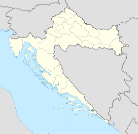
sửa{{Bản đồ định vị nhiều | Croatia
| width = 280
| float = right
| label = Pag
| marksize = 8
| pos = right
| bg = yellow
| lat_deg = 44 | lat_min = 26
| lon_deg = 15 | lon_min = 3
| label2 = Anytown_Anywhere
| mark2 = Rouge-Admin JollyRoger.svg
| mark2size = 45
| pos2 = top
| bg2 = white
| lat2_deg = 46 | lat2_min = 30
| lon2_deg = 17 | lon2_min = 30
}}
Bản đồ có 3 nhãn (thập phân)
sửa{{Bản đồ định vị nhiều | Croatia
| width = 260
| float = right
| label = Pag
| pos = right
| marksize = 8
| lat_deg = 44.44
| lon_deg = 15.05
| label2 = Anytown
| pos2 = bottom
| bg2 = yellow
| mark2size = 8
| lat2_deg = 45.86
| lon2_deg = 17.50
| label3 = Anytown2
| pos3 = top
| bg3 = lightgreen
| lat3_deg = 46.23
| lon3_deg = 18.43
}}
Ví dụ bản đồ có hình tam giác đỏ
sửa{{Bản đồ định vị nhiều | 100x100
| AlternativeMap = LocationJamaica.svg
| float = right
| width = 250
| caption = Site of '''Hispaniola'''
| label = Hispaniola
| position = left
| background = #CCDDFF
| marksize = 1
| lat_deg = 38.2
| lon_deg = 69.3
| label2 =
| mark2 =Diamond_sheer_red_37.png
| mark2size = 42
| lat2_deg = 52.2
| lon2_deg = 73.9
| label3 = Cuba
| pos3 = left
| mark3size = 1
| lat3_deg = 59.2
| lon3_deg = 68.0
}}
Bản đồ có vài nhãn nằm ngoài bản đồ
sửa{{Bản đồ định vị nhiều | Croatia
| width = 260
| float = right
| label = Pag | position=right
| marksize = 8
| lat_deg = 44.44
| lon_deg = 15.05
| label2 = Anytown
| pos2 = bottom
| bg2 = yellow
| lat2_deg = 47.40
| lon2_deg = 12.80
| outside2 = 1 <!-- we know this point is outside the map, so don't warn about it -->
| label3 = Anytown2
| pos3 = top
| bg3 = lightgreen
| lat3_deg = 41.98
| lon3_deg = 18.43
| outside3 = 1 <!-- we know this point is outside the map, so don't warn about it -->
| label4 = North Croatia
| pos4 = left
| bg4 = lightgreen
| mark4size = 0
| lat4_deg = 46.22
| lon4_deg = 17.7
}}
Bản đồ có 9 dấu hiệu (thập phân)
sửa{{Bản đồ định vị nhiều | Croatia
| width = 260
| float = right
| label = Pag
| position = right
| lat_deg = 44.44
| lon_deg = 15.05
| label2 = Anytown
| label2_size = 110
| pos2 = bottom
| background2 = yellow
| lat2_deg = 45.86
| lon2_deg = 17.50
| label3 = Anytown2
| label3_size = 290
| pos3 = top
| background3 = green
| lat3_deg = 46.23
| lon3_deg = 18.43
| mark4 =Diamond_sheer_black_20.png
| mark4size = 19
| label4 = 44.0 (latitude)
| lat4_deg = 44.00
| lon4_deg = 13.5
| mark5 =Diamond_sheer_black_20.png
| mark5size = 20
| label5 = 44.5
| lat5_deg = 44.50
| lon5_deg = 13.5
| mark6 =Diamond_sheer_black_20.png
| mark6size = 20
| label6 = 45.0
| lat6_deg = 45.00
| lon6_deg = 13.5
| mark7 =Diamond_sheer_black_20.png
| mark7size = 20
| label7 = 45.5
| lat7_deg = 45.50
| lon7_deg = 13.5
| mark8 =Diamond_sheer_black_20.png
| mark8size = 20
| label8 = 46.0
| lat8_deg = 46.00
| lon8_deg = 13.5
| label9 = ''CROATIA''
| label9_size = 165
| mark9size = <!--label only-->1
| lat9_deg = 42.60
| lon9_deg = 14.4
}}
Bản đồ có nhãn tùy chỉnh và màu nền văn bản
sửa{{Bản đồ định vị nhiều | Croatia
| width = 280
| float = right
| caption = Imotski in Croatia
| label = Imotski
| position = right
| background = #FFFFDD
| lat_deg = 43.44
| lon_deg = 17.21
}}
Bản đồ có dấu hiệu mở rộng và nhãn
sửa{{Bản đồ định vị nhiều | Croatia
| width = 260
| float = right
| caption = Pag Island in Croatia
| label = Pag
| label_size = 200
| position = right
| marksize = 14
| background = #FFFFDD
| lat_deg = 44.44
| lon_deg = 15.05
}}
Bản đồ không có chú thích
sửa{{Bản đồ định vị nhiều | Bosnia
| width = 150
| float = right
| caption =
| label = Brčko
| position = left
| lat_deg = 44.87
| lon_deg = 18.81
}}
Tây bán cầu
sửa{{Bản đồ định vị nhiều | United Kingdom
| width = 180
| float = right
| caption = Lockerbie in Scotland
| label = Lockerbie
| position = right
| lat_deg = 55 | lat_min=07 | lat_sec=16 | lat_dir=N
| lon_deg = 3 | lon_min=21 | lon_sec=19 | lon_dir=W
}}
Quốc gia nằm trên kinh tuyến 180°
sửa{{Bản đồ định vị nhiều | Russia
| width = 400
| float = right
| label = Uelen
| position = left
| background = #FFFFDD
| lat_deg = 66 | lat_min = 09 | lat_dir = N
| lon_deg = 169 | lon_min = 48 | lon_dir = W
}}
Các ví dụ dấu hiệu
sửa

- Xem các biểu tượng con trỏ Wikimedia: commons:Category:Map pointers.
Ghi chú bổ sung
sửaThe map with markers/labels is implemented as nested HTML divisions. The map-image is in an HTML division, containing each point as a percent-locator division containing a marker-image sub-division plus a label sub-division. Each point is calculated (for a percent-locator division) with X or Y coordinate "XX.X%" or "YY.Y%" as follows:
- The div-tag is "<div style="position: absolute; z-index: 2; top: XX.X%; left: YY.Y%; ...>"
- For placing latitude, the calculation is:
- XX.X% = 100 * (top - (lat_deg + latmin/60 +latsec/3600) ) / (top - bottom)
- If lat_deg is empty, the combined decimal latitude is used from "lat".
- If lat_dir is "S" (south), the latitude is multiplied by -1.
- (Note latitude is positioned in reverse, from top of map downward.)
- For placing longitude, the calculation is:
- YY.Y% = 100 * ( (lon_deg + lonmin/60 +lonsec/3600) - left ) / (right - left)
- If lon_deg is empty, the combined decimal longitude is used as "long".
- If lon_dir is "W" (west), the longitude is multiplied by -1.
- The div-tag is ended as "height: 0; width: 0; margin: 0; padding: 0;">".
- Within that division the marker/label sub-divisions are coded as:
- <div style="position: relative text-align: center; ...">.
- For label position, the options are shifted as:
- when position=left, adds "left: -6.5em; text-align: right;"
- when position=right, adds "left: 0.5em; text-align: left;"
- when position=top, adds "top:-2.65em; left:-3em; text-align: center;"
- when position=bottom, adds "top:-0.15em; left: -3em; text-align: center;" to div-tag.
Xem thêm
sửa- Bản mẫu:Bản đồ định vị - placing one marker/label by latitude/longitude.
- Bản mẫu:Bản đồ định vị+ - placing unlimited list of markers/labels.
- Commons:Category:Map pointers - list of the many Wikimedia Commons pointer symbols.


