Tập tin:04 metu Buhayrat 300 2.jpg

Kích thước hình xem trước: 800×579 điểm ảnh. Độ phân giải khác: 320×231 điểm ảnh | 640×463 điểm ảnh | 1.024×741 điểm ảnh | 1.280×926 điểm ảnh | 2.303×1.666 điểm ảnh.
Tập tin gốc (2.303×1.666 điểm ảnh, kích thước tập tin: 3,82 MB, kiểu MIME: image/jpeg)
Tập tin này từ Wikimedia Commons. Trang miêu tả nó ở đấy được sao chép dưới đây. Commons là kho lưu trữ tập tin phương tiện có giấy phép tự do. Bạn có thể tham gia. |
| Miêu tả |
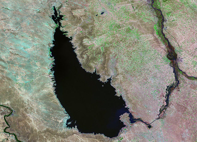
English: Base map image of Lake Tharthar, Iraq, taken in 1990 by Landsat 5. |
|||||
| Ngày | ||||||
| Nguồn gốc | NASA Landsat-5 satellite | |||||
| Tác giả | Earth Satellite Corporation for NASA | |||||
| Giấy phép (Dùng lại tập tin) |
|

Source
NASA Satellites Allow USDA to See World’s Lakes Rise and Fall archive copy at the Wayback Machine
Lịch sử tập tin
Nhấn vào ngày/giờ để xem nội dung tập tin tại thời điểm đó.
| Ngày/giờ | Hình xem trước | Kích cỡ | Thành viên | Miêu tả | |
|---|---|---|---|---|---|
| hiện tại | 15:53, ngày 28 tháng 5 năm 2008 | | 2.303×1.666 (3,82 MB) | Ando228 | {{Information |Description={{en|1=Base map image of Lake Tharthar taken in 1990 by Landsat 5.}} |Source=NASA Landsat-5 satellite |Author=Earth Satellite Corporation for NASA |Date=1990 |Permission={{PD-USGov-NASA}} |other_versions= }} {{ImageUpload|full} |
Trang sử dụng tập tin
Có 1 trang tại Wikipedia tiếng Việt có liên kết đến tập tin (không hiển thị trang ở các dự án khác):
Sử dụng tập tin toàn cục
Những wiki sau đang sử dụng tập tin này:
- Trang sử dụng tại ar.wikipedia.org
- Trang sử dụng tại be.wikipedia.org
- Trang sử dụng tại ceb.wikipedia.org
- Trang sử dụng tại cv.wikipedia.org
- Trang sử dụng tại de.wikipedia.org
- Trang sử dụng tại en.wikipedia.org
- Trang sử dụng tại es.wikipedia.org
- Trang sử dụng tại et.wikipedia.org
- Trang sử dụng tại fa.wikipedia.org
- Trang sử dụng tại id.wikipedia.org
- Trang sử dụng tại it.wikipedia.org
- Trang sử dụng tại ja.wikipedia.org
- Trang sử dụng tại lt.wikipedia.org
- Trang sử dụng tại lv.wikipedia.org
- Trang sử dụng tại nn.wikipedia.org
- Trang sử dụng tại pt.wikipedia.org
- Trang sử dụng tại ru.wikipedia.org
- Trang sử dụng tại sr.wikipedia.org
- Trang sử dụng tại uk.wikipedia.org
- Trang sử dụng tại ur.wikipedia.org
- Trang sử dụng tại www.wikidata.org