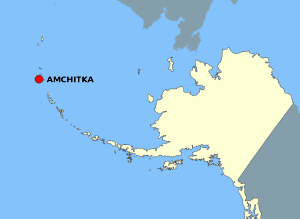
Tập tin:AmchitkaAlaskaLoc.png
AmchitkaAlaskaLoc.png (300×219 điểm ảnh, kích thước tập tin: 14 kB, kiểu MIME: image/png)
Lịch sử tập tin
Nhấn vào ngày/giờ để xem nội dung tập tin tại thời điểm đó.
| Ngày/giờ | Hình xem trước | Kích cỡ | Thành viên | Miêu tả | |
|---|---|---|---|---|---|
| hiện tại | 21:20, ngày 2 tháng 8 năm 2007 |  | 300×219 (14 kB) | Adam~commonswiki | {{Information |Description=This map is a derivative work of a map layer from nationalatlas.gov, which states: "We have begun by collaboratively building "frameworks," the essential map layers that provide a foundation for all other maps. These basic layer |
Trang sử dụng tập tin
Có 1 trang tại Wikipedia tiếng Việt có liên kết đến tập tin (không hiển thị trang ở các dự án khác):
Sử dụng tập tin toàn cục
Những wiki sau đang sử dụng tập tin này:
- Trang sử dụng tại ar.wikipedia.org
- Trang sử dụng tại az.wikipedia.org
- Trang sử dụng tại cs.wikipedia.org
- Trang sử dụng tại en.wikipedia.org
- Trang sử dụng tại eo.wikipedia.org
- Trang sử dụng tại es.wikipedia.org
- Trang sử dụng tại fr.wikipedia.org
- Trang sử dụng tại gl.wikipedia.org
- Trang sử dụng tại ha.wikipedia.org
- Trang sử dụng tại hu.wikipedia.org
- Trang sử dụng tại ig.wikipedia.org
- Trang sử dụng tại rm.wikipedia.org
- Trang sử dụng tại ro.wikipedia.org
- Trang sử dụng tại ru.wikipedia.org
- Trang sử dụng tại uk.wikipedia.org
- Trang sử dụng tại zh.wikipedia.org

