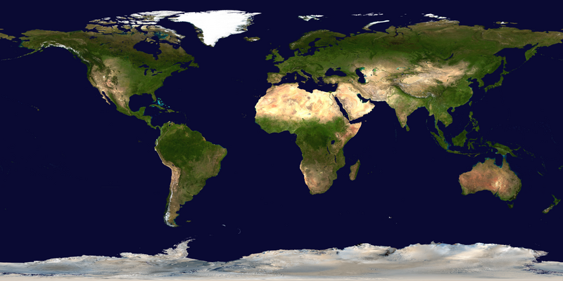
Tập tin:Blue Marble 2002.png

Kích thước hình xem trước: 800×400 điểm ảnh. Độ phân giải khác: 320×160 điểm ảnh | 640×320 điểm ảnh | 1.024×512 điểm ảnh | 1.280×640 điểm ảnh | 2.560×1.280 điểm ảnh | 43.200×21.600 điểm ảnh.
Tập tin gốc (43.200×21.600 điểm ảnh, kích thước tập tin: 529,58 MB, kiểu MIME: image/png)
Lịch sử tập tin
Nhấn vào ngày/giờ để xem nội dung tập tin tại thời điểm đó.
| Ngày/giờ | Hình xem trước | Kích cỡ | Thành viên | Miêu tả | |
|---|---|---|---|---|---|
| hiện tại | 10:34, ngày 23 tháng 7 năm 2023 |  | 43.200×21.600 (529,58 MB) | Gioppolognomo | Reverted to version as of 11:53, 5 August 2016 (UTC) |
| 10:28, ngày 23 tháng 7 năm 2023 |  | 5.400×2.700 (41,8 MB) | Gioppolognomo | ||
| 11:53, ngày 5 tháng 8 năm 2016 |  | 43.200×21.600 (529,58 MB) | Meow | c:User:Rillke/bigChunkedUpload.js: |
Trang sử dụng tập tin
Có 2 trang tại Wikipedia tiếng Việt có liên kết đến tập tin (không hiển thị trang ở các dự án khác):
Sử dụng tập tin toàn cục
Những wiki sau đang sử dụng tập tin này:
- Trang sử dụng tại ar.wikipedia.org
- Trang sử dụng tại bcl.wikipedia.org
- Trang sử dụng tại bn.wikipedia.org
- Trang sử dụng tại en.wikipedia.org
- Earth observation satellite
- World map
- Equirectangular projection
- Wikipedia:Featured pictures thumbs/04
- User talk:Nnfolz
- Wikipedia:Featured pictures/Space/Looking back
- Talk:Fishing vessel
- User:Huggums537
- Template talk:GeoTemplate/Archive 15
- Wikipedia:Featured picture candidates/delist/2020
- Wikipedia:Featured picture candidates/delist/Blue Marble
- User:GTAVCV20022013
- User:Hurricane Noah/TCMap/Current
- User:Hurricane Noah/TCMap
- User:Hurricane Noah/TCMap/Maps
- User talk:HighInBC/Archive 83
- User:LoekVV
- Portal:World
- Wikipedia:Picture of the day/January 2023
- User:SuperPentagonAnimations/sandbox
- Wikipedia talk:WikiProject Weather/Colour discussions
- Template:POTD/2023-01-11
- Wikipedia:Main Page history/2023 January 11
- Wikipedia:Main Page history/2023 January 11b
- Trang sử dụng tại en.wikibooks.org
- Trang sử dụng tại fa.wikipedia.org
- Trang sử dụng tại fr.wikipedia.org
- Trang sử dụng tại ha.wikipedia.org
- Trang sử dụng tại he.wikipedia.org
- Trang sử dụng tại it.wikibooks.org
- Trang sử dụng tại mk.wikipedia.org
- Trang sử dụng tại pnb.wikipedia.org
- Trang sử dụng tại th.wikipedia.org
- Trang sử dụng tại tr.wikipedia.org
- Trang sử dụng tại tum.wikipedia.org
- Trang sử dụng tại tw.wikipedia.org
- Trang sử dụng tại ur.wikipedia.org


