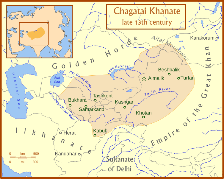
Tập tin:Chagatai Khanate map en.svg

Kích thước bản xem trước PNG này của tập tin SVG: 753×600 điểm ảnh. Độ phân giải khác: 301×240 điểm ảnh | 603×480 điểm ảnh | 964×768 điểm ảnh | 1.280×1.020 điểm ảnh | 2.560×2.039 điểm ảnh | 811×646 điểm ảnh.
Tập tin gốc (tập tin SVG, 811×646 điểm ảnh trên danh nghĩa, kích thước: 468 kB)
Lịch sử tập tin
Nhấn vào ngày/giờ để xem nội dung tập tin tại thời điểm đó.
| Ngày/giờ | Hình xem trước | Kích cỡ | Thành viên | Miêu tả | |
|---|---|---|---|---|---|
| hiện tại | 04:50, ngày 15 tháng 7 năm 2008 |  | 811×646 (468 kB) | MapMaster | +river name, + colour adjustment |
| 04:13, ngày 15 tháng 7 năm 2008 |  | 811×646 (454 kB) | MapMaster | made a few corrections to version | |
| 04:07, ngày 15 tháng 7 năm 2008 |  | 811×646 (426 kB) | MapMaster | {{Information |Description={{en|1=A map of the Chagatai Khanate, late 13th century}} |Source=Own work by uploader |Author=MapMaster |Date=14 July 2008 |Permission= |other_versions= }} {{ImageUpload|full}} |
Trang sử dụng tập tin
Có 2 trang tại Wikipedia tiếng Việt có liên kết đến tập tin (không hiển thị trang ở các dự án khác):
Sử dụng tập tin toàn cục
Những wiki sau đang sử dụng tập tin này:
- Trang sử dụng tại azb.wikipedia.org
- Trang sử dụng tại az.wikipedia.org
- Trang sử dụng tại bg.wikipedia.org
- Trang sử dụng tại bn.wikipedia.org
- Trang sử dụng tại ca.wikipedia.org
- Trang sử dụng tại ce.wikipedia.org
- Trang sử dụng tại crh.wikipedia.org
- Trang sử dụng tại da.wikipedia.org
- Trang sử dụng tại de.wikipedia.org
- Trang sử dụng tại el.wikipedia.org
- Trang sử dụng tại en.wikipedia.org
- Trang sử dụng tại eo.wikipedia.org
- Trang sử dụng tại et.wikipedia.org
- Trang sử dụng tại fr.wikipedia.org
- Trang sử dụng tại he.wikipedia.org
- Trang sử dụng tại hi.wikipedia.org
- Trang sử dụng tại hr.wikipedia.org
- Trang sử dụng tại hu.wikipedia.org
- Trang sử dụng tại it.wikipedia.org
- Trang sử dụng tại ja.wikipedia.org
- Trang sử dụng tại kk.wikipedia.org
- Trang sử dụng tại ko.wikipedia.org
- Trang sử dụng tại lt.wikipedia.org
- Trang sử dụng tại mk.wikipedia.org
- Trang sử dụng tại mn.wikipedia.org
- Trang sử dụng tại nl.wikipedia.org
- Trang sử dụng tại oc.wikipedia.org
- Trang sử dụng tại pl.wikipedia.org
- Trang sử dụng tại pnb.wikipedia.org
Xem thêm các trang toàn cục sử dụng tập tin này.