Tập tin:Conneaut Ohio aerial view.jpg

Kích thước hình xem trước: 800×561 điểm ảnh. Độ phân giải khác: 320×224 điểm ảnh | 640×449 điểm ảnh | 1.024×718 điểm ảnh | 1.280×898 điểm ảnh | 1.500×1.052 điểm ảnh.
Tập tin gốc (1.500×1.052 điểm ảnh, kích thước tập tin: 697 kB, kiểu MIME: image/jpeg)
Tập tin này từ Wikimedia Commons. Trang miêu tả nó ở đấy được sao chép dưới đây. Commons là kho lưu trữ tập tin phương tiện có giấy phép tự do. Bạn có thể tham gia. |
Miêu tả
| Miêu tả |
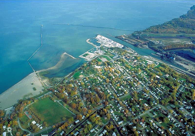
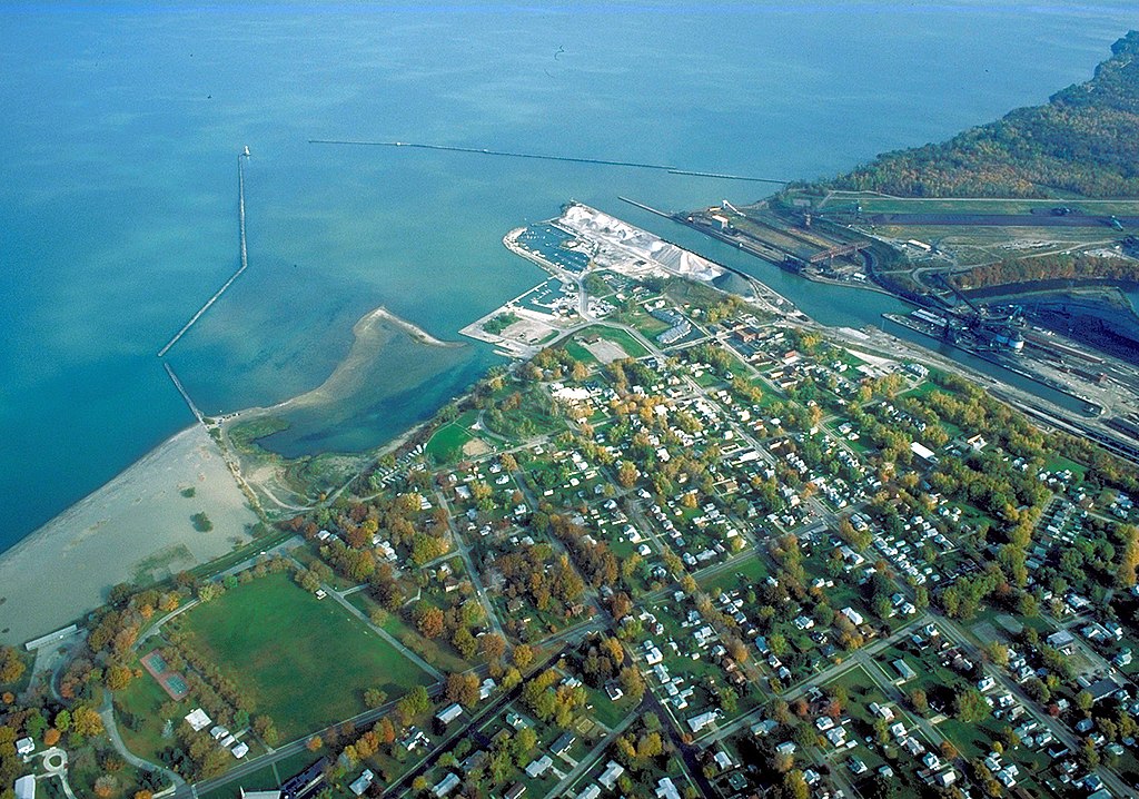
English: Aerial view of the port and harbor at Conneaut, Ohio, USA, on Lake Erie. View is to the northeast over the lake. |
| Ngày | Taken on 28 tháng 10 năm 1992 |
| Nguồn gốc |
U.S. Army Corps of Engineers Digital Visual Library Image page Image description page Digital Visual Library home page |
| Tác giả | Ken Winters, U.S. Army Corps of Engineers |
| Vị trí | Conneaut, Ohio, USA |
| Vị trí máy chụp hình | | Xem hình này và các hình ảnh lân cận trên: OpenStreetMap |
|---|
Giấy phép
This image or file is a work of a U.S. Army Corps of Engineers soldier or employee, taken or made as part of that person's official duties. As a work of the U.S. federal government, the image is in the public domain.
|
Lịch sử tập tin
Nhấn vào ngày/giờ để xem nội dung tập tin tại thời điểm đó.
| Ngày/giờ | Hình xem trước | Kích cỡ | Thành viên | Miêu tả | |
|---|---|---|---|---|---|
| hiện tại | 05:54, ngày 31 tháng 3 năm 2007 | | 1.500×1.052 (697 kB) | DanMS | {{Information | Description = {{en|Aerial view of the port and harbor at Conneaut, Ohio, USA, on Lake Erie. View is to the northeast over the lake.}} | Source = U.S. Army Corps of Engineers Digital Visual Library<br />[http://images.usace.army. |
Trang sử dụng tập tin
Có 1 trang tại Wikipedia tiếng Việt có liên kết đến tập tin (không hiển thị trang ở các dự án khác):
Sử dụng tập tin toàn cục
Những wiki sau đang sử dụng tập tin này:
- Trang sử dụng tại ar.wikipedia.org
- Trang sử dụng tại arz.wikipedia.org
- Trang sử dụng tại azb.wikipedia.org
- Trang sử dụng tại ca.wikipedia.org
- Trang sử dụng tại ceb.wikipedia.org
- Trang sử dụng tại ce.wikipedia.org
- Trang sử dụng tại cy.wikipedia.org
- Trang sử dụng tại dag.wikipedia.org
- Trang sử dụng tại de.wikipedia.org
- Trang sử dụng tại en.wikipedia.org
- Trang sử dụng tại en.wikivoyage.org
- Trang sử dụng tại es.wikipedia.org
- Trang sử dụng tại eu.wikipedia.org
- Trang sử dụng tại fa.wikipedia.org
- Trang sử dụng tại fr.wikipedia.org
- Trang sử dụng tại ht.wikipedia.org
- Trang sử dụng tại hu.wikipedia.org
- Trang sử dụng tại it.wikipedia.org
- Trang sử dụng tại ky.wikipedia.org
- Trang sử dụng tại lld.wikipedia.org
- Trang sử dụng tại pl.wikipedia.org
- Trang sử dụng tại pt.wikipedia.org
- Trang sử dụng tại sh.wikipedia.org
- Trang sử dụng tại simple.wikipedia.org
- Trang sử dụng tại sr.wikipedia.org
- Trang sử dụng tại szl.wikipedia.org
- Trang sử dụng tại tr.wikipedia.org
- Trang sử dụng tại tt.wikipedia.org
- Trang sử dụng tại uk.wikipedia.org
- Trang sử dụng tại uz.wikipedia.org
- Trang sử dụng tại vo.wikipedia.org
- Trang sử dụng tại www.wikidata.org
- Trang sử dụng tại zh-min-nan.wikipedia.org