Tập tin:Cornish windsor bridge.jpg
Kích thước hình xem trước: 800×560 điểm ảnh. Độ phân giải khác: 320×224 điểm ảnh | 640×448 điểm ảnh | 1.024×717 điểm ảnh | 1.280×896 điểm ảnh | 2.560×1.793 điểm ảnh | 4.567×3.198 điểm ảnh.
Tập tin gốc (4.567×3.198 điểm ảnh, kích thước tập tin: 1,49 MB, kiểu MIME: image/jpeg)
Tập tin này từ Wikimedia Commons. Trang miêu tả nó ở đấy được sao chép dưới đây. Commons là kho lưu trữ tập tin phương tiện có giấy phép tự do. Bạn có thể tham gia. |
|
This is an image of a place or building that is listed on the National Register of Historic Places in the United States of America. Its reference number is 76000135. |
| Vị trí máy chụp hình | | Xem hình này và các hình ảnh lân cận trên: OpenStreetMap |
|---|
| Miêu tả |
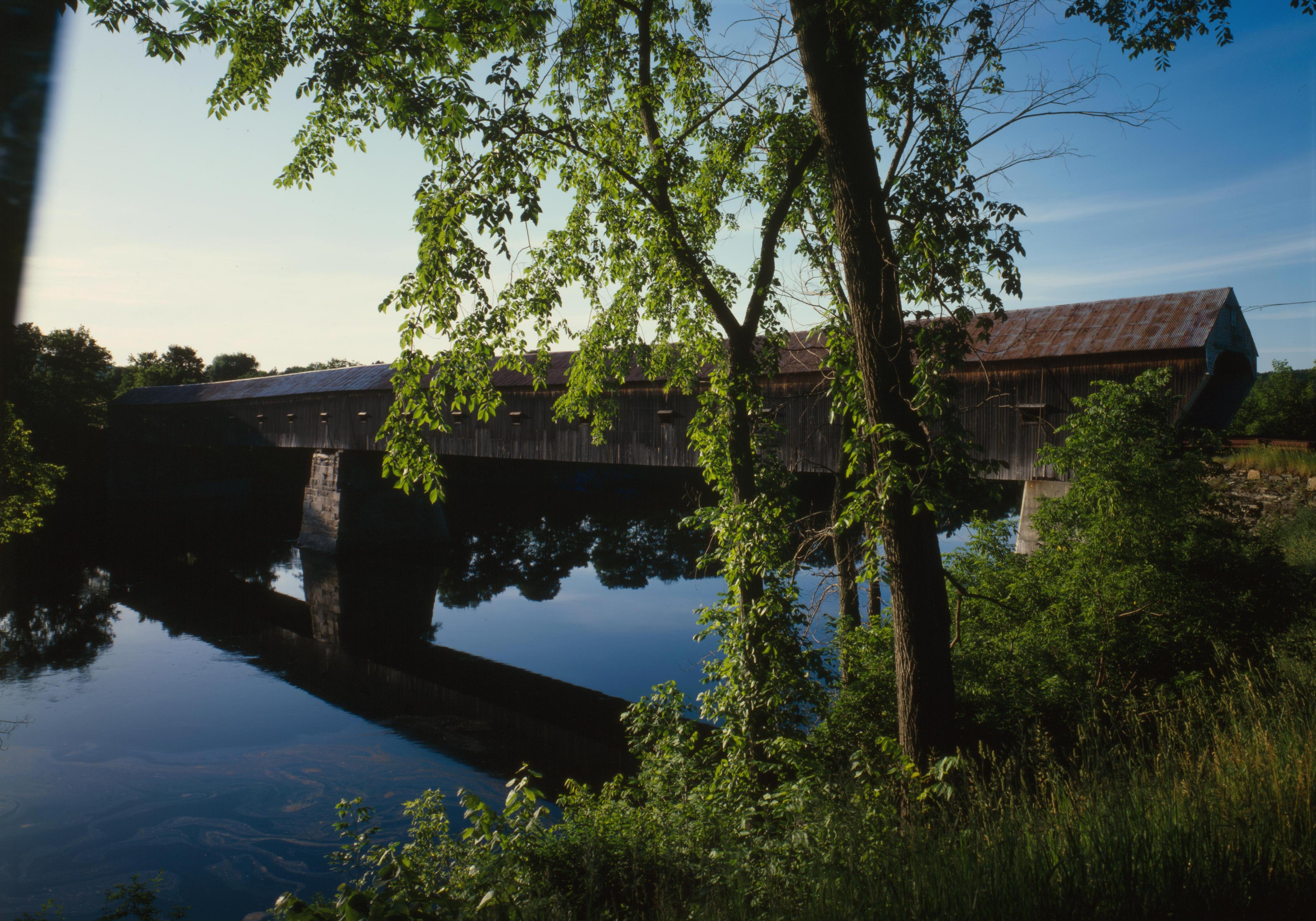
English: Southern (downstream) side of the Cornish-Windsor Covered Bridge, which spans the end of the Zoarville Bridge, which spans the Connecticut River between Cornish, New Hampshire and Windsor, Vermont, in the United States. Built in 1866, it is listed on the National Register of Historic Places. |
|||||||||||||||||||||||
| Ngày | ||||||||||||||||||||||||
| Nguồn gốc | Library of Congress, Prints and Photograph Division HAER: NH,10-CORN,2-11 | |||||||||||||||||||||||
| Tác giả |
|
|||||||||||||||||||||||
| Giấy phép (Dùng lại tập tin) |
|
|||||||||||||||||||||||
.jpg)

|
This image is available from the United States Library of Congress's Prints and Photographs division
under the digital ID hhh.nh0177. This tag does not indicate the copyright status of the attached work. A normal copyright tag is still required. See Commons:Licensing.
|
Lịch sử tập tin
Nhấn vào ngày/giờ để xem nội dung tập tin tại thời điểm đó.
| Ngày/giờ | Hình xem trước | Kích cỡ | Thành viên | Miêu tả | |
|---|---|---|---|---|---|
| hiện tại | 17:32, ngày 6 tháng 9 năm 2009 | | 4.567×3.198 (1,49 MB) | Cropbot | upload cropped version, operated by User:Finavon. Summary: border cropped |
| 05:07, ngày 14 tháng 8 năm 2009 |  | 4.911×3.556 (1,69 MB) | Nyttend | {{Location|43|28|26|N|72|23|1|W}} {{Information |Description={{en|Southern (downstream) side of the {{w|Cornish-Windsor Covered Bridge}}, which spans the end of the {{w|Zoarville Bridge}}, which spans the {{w|Connecticut River}} between {{w|Cornish, New H |
Trang sử dụng tập tin
Có 1 trang tại Wikipedia tiếng Việt có liên kết đến tập tin (không hiển thị trang ở các dự án khác):
Sử dụng tập tin toàn cục
Những wiki sau đang sử dụng tập tin này:
- Trang sử dụng tại ar.wikipedia.org
- Trang sử dụng tại de.wikipedia.org
- Trang sử dụng tại en.wikipedia.org
- Windsor, Vermont
- List of Historic Civil Engineering Landmarks
- National Register of Historic Places listings in Windsor County, Vermont
- Portal:U.S. roads/Did you know
- List of bridges on the National Register of Historic Places in New Hampshire
- List of bridges on the National Register of Historic Places in Vermont
- Portal:U.S. roads/Did you know/October 2011
- User:Eurodog/sandbox153
- Trang sử dụng tại es.wikipedia.org
- Trang sử dụng tại fr.wikipedia.org
- Trang sử dụng tại zh.wikipedia.org