Tập tin:Donaucity from Danube River to Northnorthwest - Vienna-.jpg

Kích thước hình xem trước: 800×268 điểm ảnh. Độ phân giải khác: 320×107 điểm ảnh | 640×215 điểm ảnh | 1.024×343 điểm ảnh | 1.280×429 điểm ảnh | 2.560×858 điểm ảnh | 11.210×3.758 điểm ảnh.
Tập tin gốc (11.210×3.758 điểm ảnh, kích thước tập tin: 11,72 MB, kiểu MIME: image/jpeg)
Tập tin này từ Wikimedia Commons. Trang miêu tả nó ở đấy được sao chép dưới đây. Commons là kho lưu trữ tập tin phương tiện có giấy phép tự do. Bạn có thể tham gia. |
Miêu tả
| Miêu tả |
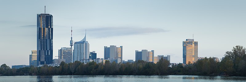
Deutsch: Morgenpanorama der Donau City mit DC-Tower 1 und Vienna International Center English: Early morning panoramic view of Donau City, view from Handelskai to northnorthwest, Including DC-Tower 1, Donauturm and Vienna International Center
|
||||||||||
| Ngày | |||||||||||
| Nguồn gốc | Tác phẩm được tạo bởi người tải lên | ||||||||||
| Tác giả | Hubertl | ||||||||||
| Giấy phép (Dùng lại tập tin) |
|

_-_Bust_in_the_Arkadenhof,_University_of_Vienna_-_0278.jpg)


| Vị trí máy chụp hình | | Xem hình này và các hình ảnh lân cận trên: OpenStreetMap |
|---|
Giấy phép
Tôi, người giữ bản quyền tác phẩm này, từ đây phát hành nó theo giấy phép sau:
Tập tin này được phát hành theo Giấy phép Creative Commons Ghi công–Chia sẻ tương tự 4.0 Quốc tế.
- Bạn được phép:
- chia sẻ – sao chép, phân phối và chuyển giao tác phẩm
- pha trộn – để chuyển thể tác phẩm
- Theo các điều kiện sau:
- ghi công – Bạn phải ghi lại tác giả và nguồn, liên kết đến giấy phép, và các thay đổi đã được thực hiện, nếu có. Bạn có thể làm các điều trên bằng bất kỳ cách hợp lý nào, miễn sao không ám chỉ rằng người cho giấy phép ủng hộ bạn hay việc sử dụng của bạn.
- chia sẻ tương tự – Nếu bạn biến tấu, biến đổi, hoặc làm tác phẩm khác dựa trên tác phẩm này, bạn chỉ được phép phân phối tác phẩm mới theo giấy phép y hệt hoặc tương thích với tác phẩm gốc.
Ảnh này đã được xem xét dựa trên Tiêu chuẩn hình ảnh và được đánh giá là một hình ảnh chất lượng.
|
Lịch sử tập tin
Nhấn vào ngày/giờ để xem nội dung tập tin tại thời điểm đó.
| Ngày/giờ | Hình xem trước | Kích cỡ | Thành viên | Miêu tả | |
|---|---|---|---|---|---|
| hiện tại | 12:46, ngày 3 tháng 11 năm 2014 | 11.210×3.758 (11,72 MB) | Hubertl | geschärft, entbläut | |
| 10:01, ngày 20 tháng 10 năm 2014 | 14.138×4.914 (18,76 MB) | Hubertl | Dust spot removed! Thanks, Livio.... | ||
| 01:57, ngày 20 tháng 10 năm 2014 | 14.138×4.914 (18,77 MB) | Hubertl | Removing bird, looking like dustspot | ||
| 20:05, ngày 19 tháng 10 năm 2014 | 14.138×4.914 (18,77 MB) | Hubertl |
Trang sử dụng tập tin
Có 1 trang tại Wikipedia tiếng Việt có liên kết đến tập tin (không hiển thị trang ở các dự án khác):
Sử dụng tập tin toàn cục
Những wiki sau đang sử dụng tập tin này:
- Trang sử dụng tại bn.wikipedia.org
- Trang sử dụng tại de.wikipedia.org
- Trang sử dụng tại de.wikivoyage.org
- Trang sử dụng tại el.wikipedia.org
- Trang sử dụng tại en.wikipedia.org
- Trang sử dụng tại hi.wikipedia.org
- Trang sử dụng tại io.wikipedia.org
- Trang sử dụng tại pt.wikipedia.org