Tập tin:Dorf Tirol pflicht.jpg
Kích thước hình xem trước: 748×600 điểm ảnh. Độ phân giải khác: 300×240 điểm ảnh | 599×480 điểm ảnh | 958×768 điểm ảnh | 1.255×1.006 điểm ảnh.
Tập tin gốc (1.255×1.006 điểm ảnh, kích thước tập tin: 241 kB, kiểu MIME: image/jpeg)
Tập tin này từ Wikimedia Commons. Trang miêu tả nó ở đấy được sao chép dưới đây. Commons là kho lưu trữ tập tin phương tiện có giấy phép tự do. Bạn có thể tham gia. |
Miêu tả
| Miêu tả |
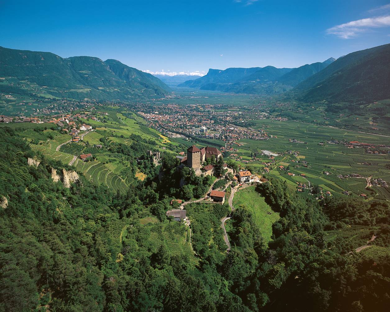
English: Landscape around the village Dorf Tirol: Tirol castle with Dorf Tirol to the left and Meran down in the valley. |
||
| Nguồn gốc | Tappeiner | ||
| Tác giả | Tappeiner | ||
| Giấy phép (Dùng lại tập tin) |
Copyrighted free use provided that the copyright holder of this file allows anyone to use it for any purpose |
| Vị trí đối tượng | | Xem hình này và các hình ảnh lân cận trên: OpenStreetMap |
|---|
Giấy phép

|
The copyright holder of this work allows anyone to use it for any purpose including unrestricted redistribution, commercial use, and modification.
Usage notes:
|
| Annotations | This image is annotated: View the annotations at Commons |
Lịch sử tập tin
Nhấn vào ngày/giờ để xem nội dung tập tin tại thời điểm đó.
| Ngày/giờ | Hình xem trước | Kích cỡ | Thành viên | Miêu tả | |
|---|---|---|---|---|---|
| hiện tại | 09:59, ngày 16 tháng 11 năm 2009 | | 1.255×1.006 (241 kB) | Coffee 2 | {{Information |Description={{en|1={{Information |Description= landscape of the town Dorf Tirol |Source= Tappeiner |Date= - |Author= Tappeiner |Permission= Copyrighted free use provided that the copyright holder of this file allows anyone to use it for an |
Trang sử dụng tập tin
Có 1 trang tại Wikipedia tiếng Việt có liên kết đến tập tin (không hiển thị trang ở các dự án khác):
Sử dụng tập tin toàn cục
Những wiki sau đang sử dụng tập tin này:
- Trang sử dụng tại azb.wikipedia.org
- Trang sử dụng tại de.wikipedia.org
- Trang sử dụng tại en.wikipedia.org
- Trang sử dụng tại et.wikipedia.org
- Trang sử dụng tại fa.wikipedia.org
- Trang sử dụng tại id.wikipedia.org
- Trang sử dụng tại it.wikipedia.org
- Trang sử dụng tại ja.wikipedia.org
- Trang sử dụng tại lld.wikipedia.org
- Trang sử dụng tại nl.wikipedia.org
- Trang sử dụng tại pl.wikipedia.org
- Trang sử dụng tại sv.wikipedia.org
- Trang sử dụng tại tl.wikipedia.org
- Trang sử dụng tại tr.wikipedia.org