Tập tin:EtoshaBorders.jpg
Kích thước hình xem trước: 800×365 điểm ảnh. Độ phân giải khác: 320×146 điểm ảnh | 640×292 điểm ảnh | 1.406×642 điểm ảnh.
Tập tin gốc (1.406×642 điểm ảnh, kích thước tập tin: 276 kB, kiểu MIME: image/jpeg)
Tập tin này từ Wikimedia Commons. Trang miêu tả nó ở đấy được sao chép dưới đây. Commons là kho lưu trữ tập tin phương tiện có giấy phép tự do. Bạn có thể tham gia. |
Miêu tả
| Miêu tả |
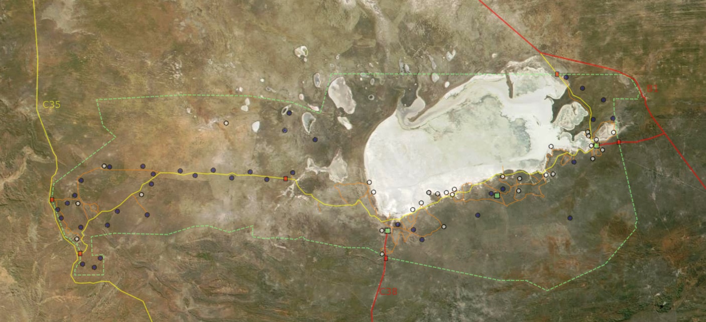
Deutsch: Satellitenbild vom Etosha Park mit Grenzen, Wegen, Wasserstellen, Camps und Toren
English: Satellite picture of Etosha park with borders, roads, waterpoints, camps and gates
Français : Vue satellite de la réserve naturelle d'Etosha, avec les limites, chemins, points d'eau, camps et portes
English: Satellite picture of the park
Français : Vue satellite du parc naturel d'Etosha
Suomi: Etoshan kansallispuisto satelliittikuvassa |
| Ngày | |
| Nguồn gốc | NASA |
| Tác giả | Modified by Harald Süpfle |
| Giấy phép (Dùng lại tập tin) |
NASA public domain |
| Phiên bản khác | cut out of original NASA file (3600x4800): ev11707_Namibia.A2001131.0920.250m.jpg |
Giấy phép
| This file is in the public domain in the United States because it was solely created by NASA. NASA copyright policy states that "NASA material is not protected by copyright unless noted". (See Template:PD-USGov, NASA copyright policy page or JPL Image Use Policy.) | ||
 |
Warnings:
|
Lịch sử tập tin
Nhấn vào ngày/giờ để xem nội dung tập tin tại thời điểm đó.
| Ngày/giờ | Hình xem trước | Kích cỡ | Thành viên | Miêu tả | |
|---|---|---|---|---|---|
| hiện tại | 22:39, ngày 18 tháng 12 năm 2006 | | 1.406×642 (276 kB) | Hsuepfle | {{Created with Inkscape}} {{Information| |Description = '''de:''' Satellitenbild vom Etosha Park mit Grenzen, Wegen, Wasserstellen, Camps und Toren * rote linie: Teerstraße * gelbe Linie: Piste * Rotes Quadrat: Parktor * Grünes Quadrat: Camp * Blauer K |
| 22:47, ngày 6 tháng 1 năm 2006 |  | 1.150×504 (176 kB) | Hsuepfle | {{Information| |Description = de: Satellitenbild vom Etosha Park mit Grenzen, Wegen, Wasserlöchern, Camps und Toren en: Satellite picture of Etosha park with borders, roads, Water holes, Camps and Gates |Source = NASA |Date = 2006-01-06 |Author = Modif |
Trang sử dụng tập tin
Có 1 trang tại Wikipedia tiếng Việt có liên kết đến tập tin (không hiển thị trang ở các dự án khác):
Sử dụng tập tin toàn cục
Những wiki sau đang sử dụng tập tin này:
- Trang sử dụng tại af.wikipedia.org
- Trang sử dụng tại be.wikipedia.org
- Trang sử dụng tại bg.wikipedia.org
- Trang sử dụng tại de.wikipedia.org
- Trang sử dụng tại en.wikipedia.org
- Trang sử dụng tại eo.wikipedia.org
- Trang sử dụng tại es.wikipedia.org
- Trang sử dụng tại fi.wikipedia.org
- Trang sử dụng tại hu.wikipedia.org
- Trang sử dụng tại it.wikipedia.org
- Trang sử dụng tại lt.wikipedia.org
- Trang sử dụng tại no.wikipedia.org
- Trang sử dụng tại pnb.wikipedia.org
- Trang sử dụng tại sk.wikipedia.org
- Trang sử dụng tại sl.wikipedia.org
- Trang sử dụng tại zh.wikipedia.org