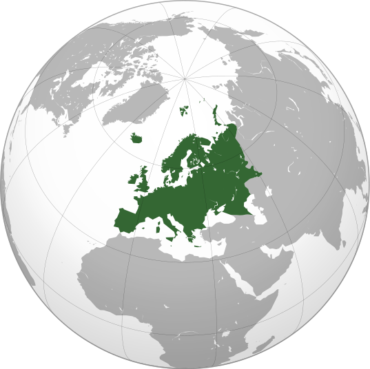
Tập tin:Europe orthographic Caucasus Urals boundary.svg

Kích thước bản xem trước PNG này của tập tin SVG: 537×536 điểm ảnh. Độ phân giải khác: 240×240 điểm ảnh | 481×480 điểm ảnh | 769×768 điểm ảnh | 1.026×1.024 điểm ảnh | 2.052×2.048 điểm ảnh.
Tập tin gốc (tập tin SVG, 537×536 điểm ảnh trên danh nghĩa, kích thước: 77 kB)
Lịch sử tập tin
Nhấn vào ngày/giờ để xem nội dung tập tin tại thời điểm đó.
| Ngày/giờ | Hình xem trước | Kích cỡ | Thành viên | Miêu tả | |
|---|---|---|---|---|---|
| hiện tại | 13:32, ngày 4 tháng 9 năm 2022 |  | 537×536 (77 kB) | M.Bitton | Reverted to version as of 12:03, 4 September 2022 (UTC): per COM:OVERWRITE |
| 13:30, ngày 4 tháng 9 năm 2022 |  | 537×536 (177 kB) | Рагин1987 | Small correction | |
| 12:03, ngày 4 tháng 9 năm 2022 |  | 537×536 (77 kB) | M.Bitton | Reverted to version as of 05:48, 12 March 2019 (UTC): per COM:OVERWRITE + fake svg | |
| 19:12, ngày 30 tháng 8 năm 2022 |  | 2.052×2.048 (874 kB) | Рагин1987 | More correct visualization of the dividing line on the territory of the Caucasus Range | |
| 05:48, ngày 12 tháng 3 năm 2019 |  | 537×536 (77 kB) | AndreyKva | Optimized. | |
| 19:25, ngày 3 tháng 3 năm 2016 |  | 537×536 (197 kB) | Denniss | Reverted to version as of 13:27, 19 October 2014 (UTC) | |
| 18:37, ngày 3 tháng 3 năm 2016 |  | 537×536 (239 kB) | Ercwlff | UC UC UC | |
| 13:27, ngày 19 tháng 10 năm 2014 |  | 537×536 (197 kB) | Deni Mataev | Again, The entirety of Georgia is not in Europe geographically, only North Eastern parts are | |
| 20:05, ngày 18 tháng 10 năm 2014 |  | 537×536 (238 kB) | Politologia | Reverted to version as of 10:57, 18 October 2014 In all maps Georgia is part of Georgia. There is at list 10 versions of borders of Europe in most of them Georgia is part of Europa | |
| 20:04, ngày 18 tháng 10 năm 2014 |  | 537×536 (238 kB) | Politologia | Reverted to version as of 10:57, 18 October 2014 In all maps Georgia is part of Georgia. |
Trang sử dụng tập tin
Có 52 trang tại Wikipedia tiếng Việt có liên kết đến tập tin (không hiển thị trang ở các dự án khác):
- Asiamerica
- Atlantica
- Avalonia
- Baltica
- Bắc Bán cầu
- Bắc Cực (lục địa)
- Bắc Mỹ
- Châu Mỹ
- Châu Nam Cực
- Châu Phi
- Châu lục
- Châu Á
- Châu Âu
- Châu Đại Dương
- Cimmeria (lục địa)
- Columbia (siêu lục địa)
- Gondwana
- Hoa hậu Các Quốc gia
- Kazakhstania
- Kenorland
- Laurasia
- Laurentia
- Lemuria (lục địa)
- Lục địa
- Lục địa Á-Âu
- Lục địa Á-Âu-Phi
- Lục địa Úc
- Mu (lục địa)
- Nam Bán cầu
- Nam Mỹ
- Nena
- Nền cổ Hoa Nam
- Pangaea Ultima
- Pannotia
- Rodinia
- Siberia (lục địa)
- Siêu lục địa
- Terra Australis
- Tiểu lục địa Ấn Độ
- Toàn Lục Địa
- Tây Bán cầu
- Ur (lục địa)
- Vaalbara
- Vùng
- Zealandia
- Á-Mỹ (lục địa)
- Âu-Mỹ (lục địa)
- Úc
- Đông Bán cầu
- Địa lý châu Á
- Thành viên:FoxSerfaty/Nháp/Bắc Mỹ
- Bản mẫu:Lục địa
Sử dụng tập tin toàn cục
Những wiki sau đang sử dụng tập tin này:
- Trang sử dụng tại ab.wikipedia.org
- Trang sử dụng tại ace.wikipedia.org
- Trang sử dụng tại ady.wikipedia.org
- Trang sử dụng tại af.wikipedia.org
- Trang sử dụng tại ar.wikipedia.org
- بوابة:آسيا
- بوابة:أوروبا
- بوابة:إفريقيا
- بوابة:القارة القطبية الجنوبية
- بوابة:القارة القطبية الجنوبية/بوابات شقيقة
- قائمة جوازات السفر
- بوابة:تركيا
- بوابة:تركيا/بوابات شقيقة
- بوابة:جغرافيا/مقالة مختارة/أرشيف
- المرأة في تركيا
- بوابة:أوروبا/واجهة
- بوابة:تصفح
- بوابة:تصفح/جغرافيا
- قائمة مفاتيح الاتصال الدولية
- المرأة في ألمانيا
- بوابة:إسطنبول
- بوابة:آسيا/بوابات شقيقة
- ويكيبيديا:مقالة الصفحة الرئيسية المختارة/398
- بوابة:جغرافيا/مقالة مختارة/21
- معاملة المثليين في أوروبا
- المرأة في أوروبا
- المرأة في البرتغال
- المرأة في فنلندا
- المرأة في مقدونيا الشمالية
- المرأة في ترانسنيستريا
- المرأة في الفاتيكان
- المرأة في أذربيجان
- المرأة في اليونان
- المرأة في ألبانيا
- المرأة في إيطاليا
- المرأة في الجبل الأسود
Xem thêm các trang toàn cục sử dụng tập tin này.

