Tập tin:NepalBajhangDistrictmap.png

Tập tin gốc (3.508×2.479 điểm ảnh, kích thước tập tin: 299 kB, kiểu MIME: image/png)
Tập tin này từ Wikimedia Commons. Trang miêu tả nó ở đấy được sao chép dưới đây. Commons là kho lưu trữ tập tin phương tiện có giấy phép tự do. Bạn có thể tham gia. |
| Miêu tả |
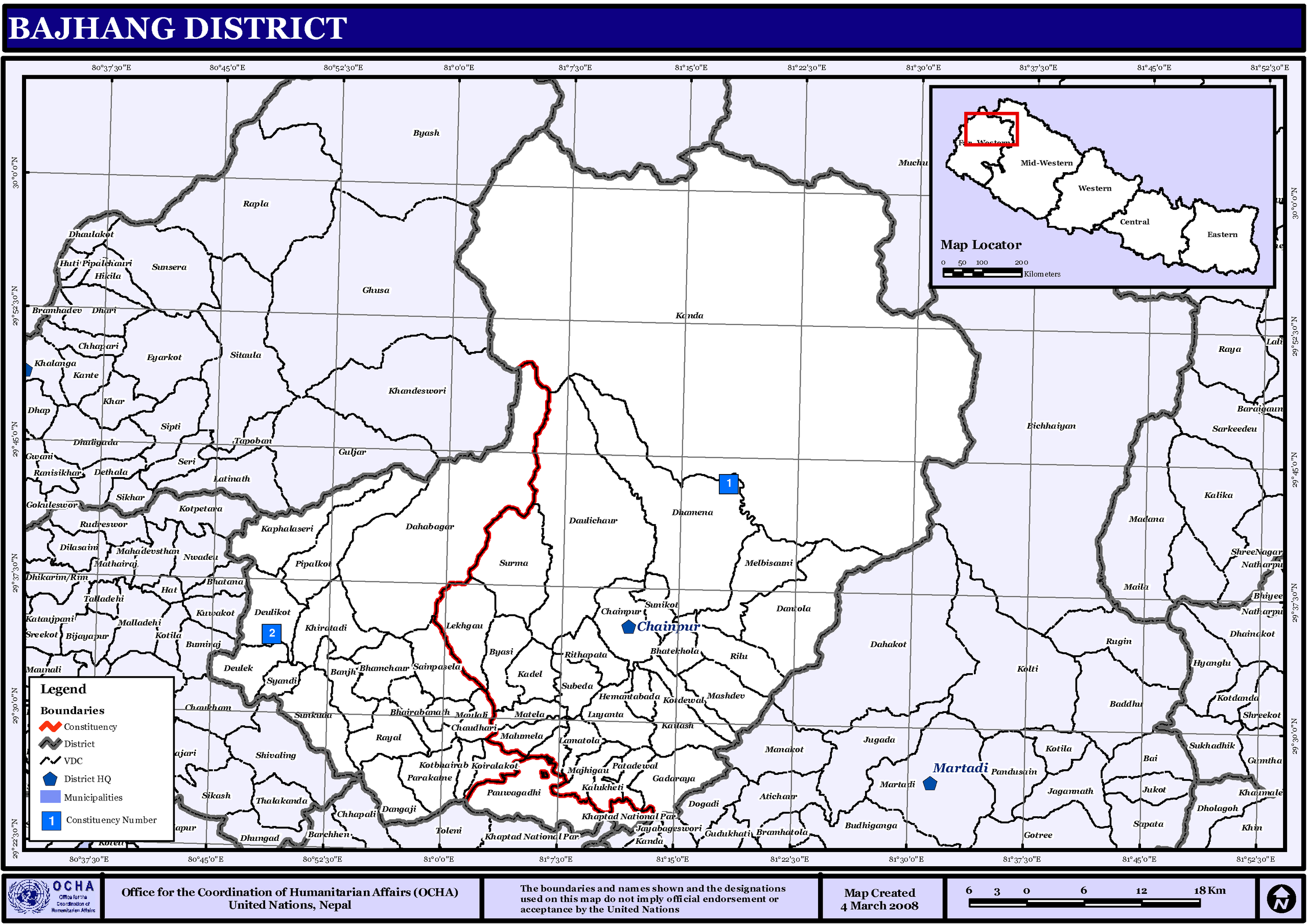
English: Map displaying Village Development Committees in Bajhang District, Nepal |
|||
| Ngày | ||||
| Nguồn gốc | http://www.un.org.np/maps/district-maps/far-western/Bajhang.pdf | |||
| Tác giả | United Nations | |||
| Giấy phép (Dùng lại tập tin) |
|

Lịch sử tập tin
Nhấn vào ngày/giờ để xem nội dung tập tin tại thời điểm đó.
| Ngày/giờ | Hình xem trước | Kích cỡ | Thành viên | Miêu tả | |
|---|---|---|---|---|---|
| hiện tại | 01:38, ngày 6 tháng 11 năm 2008 | | 3.508×2.479 (299 kB) | Sadalmelik | {{Information |Description={{en|1=Map displaying Village Development Committees in Bajhang District, Nepal}} |Source=http://www.un.org.np/maps/district-maps/far-western/Bajhang.pdf |Date=March 4, 2008 |Author=United Nations |Permission={{PD-UN}} |othe |
Trang sử dụng tập tin
Sử dụng tập tin toàn cục
Những wiki sau đang sử dụng tập tin này:
- Trang sử dụng tại de.wikipedia.org
- Trang sử dụng tại dty.wikipedia.org
- काडाँ गाउँ विकास समिती
- दगांजी गाउँ विकास समिती
- दातौला गाउँ विकास समिती
- देउलेक गाउँ विकास समिती
- पाराकाने गाउँ विकास समिती
- भातेखोला गाउँ विकास समिती
- मटेला गाउँ विकास समिती
- माझीगाउ गाउँ विकास समिती
- मालुमेला गाउँ विकास समिती
- मासदेव गाउँ विकास समिती
- मेलविसौनी गाउँ विकास समिती
- मौलाली गाउँ विकास समिती
- रायल गाउँ विकास समिती
- रिलु गाउँ विकास समिती
- लामातोला गाउँ विकास समिती
- लेकगाँउ गाउँ विकास समिती
- सुनकुडा
- सुनिकोट गाउँ विकास समिती
- सुर्मा गाउँ विकास समिती
- सैनापसेला गाउँ विकास समिती
- स्याडी गाउँ विकास समिती
- कडेल गाउँ विकास समिती
- काफलसेरी गाउँ विकास समिती
- कालुखेती गाउँ विकास समिती
- कैलाश गाउँ विकास समिती
- कोइरालाकोट
- कोटदेवल गाउँ विकास समिती
- कोटभैरभ गाउँ विकास समिती
- खडतडी गाउँ विकास समिती
- गडाराय चौतारा गाउँ विकास समिती
- चौधारी गाउँ विकास समिती
- जयपृथ्वी नगरपालिका
- दहबगर गाउँ विकास समिती
- देउलीकोट गाउँ विकास समिती
- दैलीचौर गाउँ विकास समिती
- धमेना गाउँ विकास समिती
- पाटादेवल गाउँ विकास समिती
- पीपलकोट गाउँ विकास समिती
- पौवागढी गाउँ विकास समिती
- बाँझ गाउँ विकास समिती
- भामचौर गाउँ विकास समिती
- भैरवनाथ गाउँ विकास समिती
- यासी गाउँ विकास समिती
- ढाँचा:बझाङ जिल्लाका गाविस तथा नगरपालिका
- Trang sử dụng tại en.wikipedia.org
- Trang sử dụng tại fi.wikipedia.org
- Trang sử dụng tại it.wikipedia.org
- Trang sử dụng tại mai.wikipedia.org
Xem thêm các trang toàn cục sử dụng tập tin này.