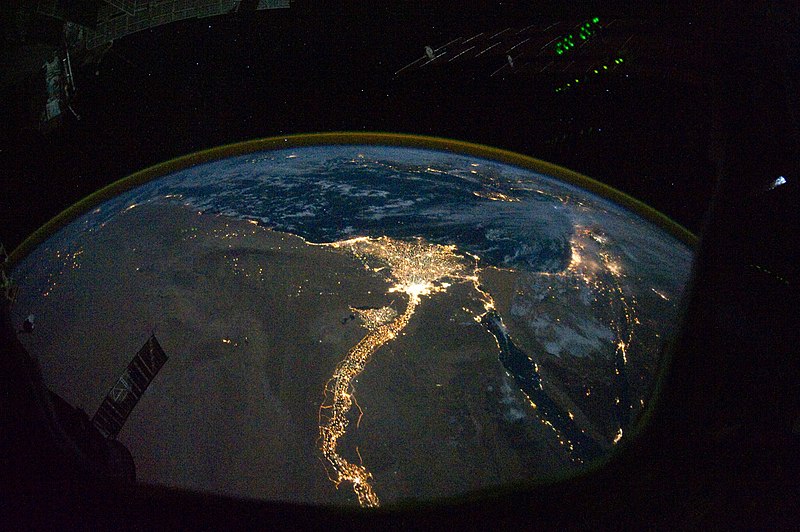
Tập tin:Nile River Delta at Night.JPG

Kích thước hình xem trước: 800×532 điểm ảnh. Độ phân giải khác: 320×213 điểm ảnh | 640×426 điểm ảnh | 1.024×681 điểm ảnh | 1.280×852 điểm ảnh | 2.560×1.703 điểm ảnh | 4.256×2.832 điểm ảnh.
Tập tin gốc (4.256×2.832 điểm ảnh, kích thước tập tin: 2,05 MB, kiểu MIME: image/jpeg)
Lịch sử tập tin
Nhấn vào ngày/giờ để xem nội dung tập tin tại thời điểm đó.
| Ngày/giờ | Hình xem trước | Kích cỡ | Thành viên | Miêu tả | |
|---|---|---|---|---|---|
| hiện tại | 12:51, ngày 8 tháng 11 năm 2010 |  | 4.256×2.832 (2,05 MB) | Originalwana | {{Information |Description={{en|1=In this view of Egypt, we see a population almost completely concentrated along the Nile Valley, just a small percentage of the country’s land area. The Nile River and its delta look like a brilliant, long-stemmed flow |
Trang sử dụng tập tin
Có 2 trang tại Wikipedia tiếng Việt có liên kết đến tập tin (không hiển thị trang ở các dự án khác):
Sử dụng tập tin toàn cục
Những wiki sau đang sử dụng tập tin này:
- Trang sử dụng tại af.wikipedia.org
- Trang sử dụng tại arz.wikipedia.org
- Trang sử dụng tại av.wikipedia.org
- Trang sử dụng tại bg.wikipedia.org
- Trang sử dụng tại bs.wikipedia.org
- Trang sử dụng tại cs.wikipedia.org
- Trang sử dụng tại el.wikipedia.org
- Trang sử dụng tại en.wikipedia.org
- Trang sử dụng tại en.wiktionary.org
- Trang sử dụng tại es.wikipedia.org
- Trang sử dụng tại ha.wikipedia.org
- Trang sử dụng tại he.wikipedia.org
- Trang sử dụng tại incubator.wikimedia.org
- Trang sử dụng tại ln.wikipedia.org
- Trang sử dụng tại ml.wikipedia.org
- Trang sử dụng tại no.wikipedia.org
- Trang sử dụng tại sd.wikipedia.org
- Trang sử dụng tại sk.wikipedia.org
- Trang sử dụng tại sl.wikipedia.org
- Trang sử dụng tại sq.wikipedia.org
- Trang sử dụng tại sq.wikiquote.org
- Trang sử dụng tại sr.wikipedia.org
- Trang sử dụng tại sv.wikipedia.org
- Trang sử dụng tại ta.wikipedia.org
- Trang sử dụng tại th.wikipedia.org
- Trang sử dụng tại tr.wikipedia.org
- Trang sử dụng tại uk.wikipedia.org
- Trang sử dụng tại ur.wikipedia.org

