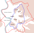
Tập tin:Roma Plan.jpg

Kích thước hình xem trước: 754×600 điểm ảnh. Độ phân giải khác: 302×240 điểm ảnh | 604×480 điểm ảnh | 966×768 điểm ảnh | 1.280×1.018 điểm ảnh | 1.840×1.463 điểm ảnh.
Tập tin gốc (1.840×1.463 điểm ảnh, kích thước tập tin: 2,5 MB, kiểu MIME: image/jpeg)
Lịch sử tập tin
Nhấn vào ngày/giờ để xem nội dung tập tin tại thời điểm đó.
| Ngày/giờ | Hình xem trước | Kích cỡ | Thành viên | Miêu tả | |
|---|---|---|---|---|---|
| hiện tại | 16:14, ngày 30 tháng 3 năm 2015 |  | 1.840×1.463 (2,5 MB) | Jonstevn | Reverted to version as of 19:01, 28 August 2006 |
| 16:10, ngày 30 tháng 3 năm 2015 |  | 1.840×1.463 (2,5 MB) | Jonstevn | Reverted to version as of 19:01, 28 August 2006 | |
| 16:10, ngày 30 tháng 3 năm 2015 |  | 1.840×1.463 (2,5 MB) | Jonstevn | Reverted to version as of 19:01, 28 August 2006 | |
| 06:40, ngày 27 tháng 7 năm 2008 |  | 1.840×1.463 (3,38 MB) | Amadscientist | {{Information |Description= |Source= |Date= |Author= |Permission= |other_versions= }} | |
| 04:57, ngày 27 tháng 7 năm 2008 |  | 4.000×3.180 (12,21 MB) | Amadscientist | {{Information |Description= |Source= |Date= |Author= |Permission= |other_versions= }} | |
| 19:01, ngày 28 tháng 8 năm 2006 |  | 1.840×1.463 (2,5 MB) | Nikephoros | {{Information |Description=Plan Roms im Altertum / Map of Rome during Antiquity |Source=G. Droysens Allgemeiner Historischer Handatlas |Date=1886 |Author=? |Permission= not needed |other_versions= no }} |
Trang sử dụng tập tin
Có 7 trang tại Wikipedia tiếng Việt có liên kết đến tập tin (không hiển thị trang ở các dự án khác):
Sử dụng tập tin toàn cục
Những wiki sau đang sử dụng tập tin này:
- Trang sử dụng tại ar.wikipedia.org
- Trang sử dụng tại as.wikipedia.org
- Trang sử dụng tại azb.wikipedia.org
- Trang sử dụng tại beta.wikiversity.org
- Trang sử dụng tại bg.wikipedia.org
- Trang sử dụng tại bn.wikipedia.org
- Trang sử dụng tại bs.wikipedia.org
- Trang sử dụng tại bxr.wikipedia.org
- Trang sử dụng tại ca.wikipedia.org
- Trang sử dụng tại ceb.wikipedia.org
- Trang sử dụng tại cs.wikipedia.org
Xem thêm các trang toàn cục sử dụng tập tin này.


