Tập tin:Staffordshire UK locator map 2010.svg

Kích thước bản xem trước PNG này của tập tin SVG: 494×600 điểm ảnh. Độ phân giải khác: 198×240 điểm ảnh | 395×480 điểm ảnh | 633×768 điểm ảnh | 843×1.024 điểm ảnh | 1.687×2.048 điểm ảnh | 1.108×1.345 điểm ảnh.
Tập tin gốc (tập tin SVG, 1.108×1.345 điểm ảnh trên danh nghĩa, kích thước: 302 kB)
Tập tin này từ Wikimedia Commons. Trang miêu tả nó ở đấy được sao chép dưới đây. Commons là kho lưu trữ tập tin phương tiện có giấy phép tự do. Bạn có thể tham gia. |
Miêu tả
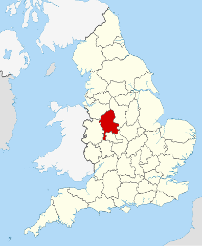
| Miêu tả | Location of the ceremonial county of Staffordshire within England. |
| Ngày | |
| Nguồn gốc |
National Geospatial-Intelligence Agency
|
| Tác giả | Nilfanion |
Giấy phép
Tôi, người giữ bản quyền tác phẩm này, từ đây phát hành nó theo các giấy phép sau:
Tập tin này được phát hành theo Giấy phép Creative Commons Ghi công - Chia sẻ tương tự 3.0 Chưa chuyển đồi
- Bạn được phép:
- chia sẻ – sao chép, phân phối và chuyển giao tác phẩm
- pha trộn – để chuyển thể tác phẩm
- Theo các điều kiện sau:
- ghi công – Bạn phải ghi lại tác giả và nguồn, liên kết đến giấy phép, và các thay đổi đã được thực hiện, nếu có. Bạn có thể làm các điều trên bằng bất kỳ cách hợp lý nào, miễn sao không ám chỉ rằng người cho giấy phép ủng hộ bạn hay việc sử dụng của bạn.
- chia sẻ tương tự – Nếu bạn biến tấu, biến đổi, hoặc làm tác phẩm khác dựa trên tác phẩm này, bạn chỉ được phép phân phối tác phẩm mới theo giấy phép y hệt hoặc tương thích với tác phẩm gốc.

|
Bạn có quyền sao chép, phân phối và/hoặc sửa đổi tài liệu này theo những điều khoản được quy định trong Giấy phép Tài liệu Tự do GNU, phiên bản 1.2 hoặc các phiên bản mới hơn được Quỹ Phần mềm Tự do; quy định; ngoại trừ những phần không được sửa đổi, bìa trước và bìa sau. Bạn có thể xem giấy phép nói trên ở phần Giấy phép Tài liệu Tự do GNU. |
Bạn có thể chọn giấy phép mà bạn muốn.

|
This is one of the images forming part of the Valued image set: Locator maps of the Ceremonial counties of England on Wikimedia Commons. The image set has been assessed under the valued image set criteria and is considered the most valued set on Commons within the scope:
Locator maps of the Ceremonial counties of England
You can see its nomination at Commons:Valued image candidates/Locator maps of English ceremonial counties. |
Lịch sử tập tin
Nhấn vào ngày/giờ để xem nội dung tập tin tại thời điểm đó.
| Ngày/giờ | Hình xem trước | Kích cỡ | Thành viên | Miêu tả | |
|---|---|---|---|---|---|
| hiện tại | 22:44, ngày 23 tháng 11 năm 2010 | | 1.108×1.345 (302 kB) | Nilfanion | == Summary == {{Information |Description=Location of the ceremonial county of Staffordshire within England. |Source=Ordnance Survey [https://www.ordnancesurvey.co.uk/opendatadownload/products.html OpenData]: *Coun |
Trang sử dụng tập tin
Có 1 trang tại Wikipedia tiếng Việt có liên kết đến tập tin (không hiển thị trang ở các dự án khác):
Sử dụng tập tin toàn cục
Những wiki sau đang sử dụng tập tin này:
- Trang sử dụng tại af.wikipedia.org
- Trang sử dụng tại ar.wikipedia.org
- Trang sử dụng tại ast.wikipedia.org
- Trang sử dụng tại be-tarask.wikipedia.org
- Trang sử dụng tại bg.wikipedia.org
- Trang sử dụng tại ca.wikipedia.org
- Trang sử dụng tại ceb.wikipedia.org
- Trang sử dụng tại cs.wikipedia.org
- Trang sử dụng tại dag.wikipedia.org
- Trang sử dụng tại de.wikipedia.org
- Trang sử dụng tại en.wikipedia.org
- Staffordshire
- Croxden
- Swinfen
- Beacon Way
- Coombes Valley RSPB reserve
- RAF Stafford
- Hopwas
- Spath
- Admaston, Staffordshire
- Armitage
- Knighton, Stafford
- Pye Green
- Whitmore, Staffordshire
- Maer, Staffordshire
- Kings Bromley
- Brindley Heath
- Stretton, East Staffordshire
- Norbury, Staffordshire
- Knightley, Staffordshire
- Loynton
- Abbey Green, Staffordshire Moorlands
- Lower Penn
- Above Church
- Great Bridgeford
- Weston-under-Lizard
- Midlands Plateau
- Template:Staffordshire-geo-stub
- Keele (ward)
- Stonydelph
- Chasetown
- Acton Trussell and Bednall
- Anglesey, Staffordshire
- Alrewas and Fradley
- Alstonefield
- Armitage with Handsacre
- Merryton Low
- Quarnford
- Upper Hulme
Xem thêm các trang toàn cục sử dụng tập tin này.