Tập tin:Stillwater Minnesota waterfront aerial view.jpg

Kích thước hình xem trước: 749×600 điểm ảnh. Độ phân giải khác: 300×240 điểm ảnh | 600×480 điểm ảnh | 959×768 điểm ảnh | 1.279×1.024 điểm ảnh | 1.500×1.201 điểm ảnh.
Tập tin gốc (1.500×1.201 điểm ảnh, kích thước tập tin: 1,05 MB, kiểu MIME: image/jpeg)
Tập tin này từ Wikimedia Commons. Trang miêu tả nó ở đấy được sao chép dưới đây. Commons là kho lưu trữ tập tin phương tiện có giấy phép tự do. Bạn có thể tham gia. |
| Miêu tả |
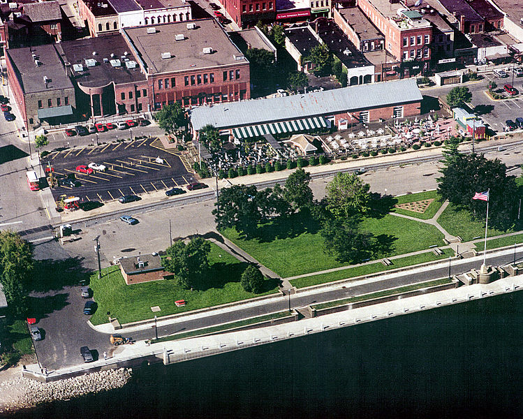
English: Aerial view of part of the waterfront section of Stillwater, Minnesota, USA, on the St. Croix River. View is to the west. The U.S. Army Corps of Engineers has constructed a floodwall along the waterfront. |
|||
| Ngày | Taken on 24 tháng 8 năm 1999 | |||
| Nguồn gốc |
U.S. Army Corps of Engineers Digital Visual Library Image page Image description page Digital Visual Library home page |
|||
| Tác giả | U.S. Army Corps of Engineers, photographer not specified or unknown | |||
| Giấy phép (Dùng lại tập tin) |
|
|||
| Vị trí | Stillwater, Washington County, Minnesota, USA |
| Vị trí máy chụp hình | | Xem hình này và các hình ảnh lân cận trên: OpenStreetMap |
|---|
Lịch sử tập tin
Nhấn vào ngày/giờ để xem nội dung tập tin tại thời điểm đó.
| Ngày/giờ | Hình xem trước | Kích cỡ | Thành viên | Miêu tả | |
|---|---|---|---|---|---|
| hiện tại | 00:08, ngày 7 tháng 4 năm 2007 | | 1.500×1.201 (1,05 MB) | DanMS | {{Information | Description = {{en|Aerial view of part of the waterfront section of Stillwater, Minnesota, USA, on the St. Croix River. View is to the west. The U.S. Army Corps of Engineers has constructed a floodwall along the waterfront.}} | |
Trang sử dụng tập tin
Có 1 trang tại Wikipedia tiếng Việt có liên kết đến tập tin (không hiển thị trang ở các dự án khác):
Sử dụng tập tin toàn cục
Những wiki sau đang sử dụng tập tin này:
- Trang sử dụng tại ar.wikipedia.org
- Trang sử dụng tại arz.wikipedia.org
- Trang sử dụng tại azb.wikipedia.org
- Trang sử dụng tại ca.wikipedia.org
- Trang sử dụng tại ceb.wikipedia.org
- Trang sử dụng tại ce.wikipedia.org
- Trang sử dụng tại dag.wikipedia.org
- Trang sử dụng tại en.wikipedia.org
- Trang sử dụng tại en.wikivoyage.org
- Trang sử dụng tại es.wikipedia.org
- Trang sử dụng tại eu.wikipedia.org
- Trang sử dụng tại fa.wikipedia.org
- Trang sử dụng tại fi.wikipedia.org
- Trang sử dụng tại fr.wikipedia.org
- Trang sử dụng tại he.wikivoyage.org
- Trang sử dụng tại ht.wikipedia.org
- Trang sử dụng tại hu.wikipedia.org
- Trang sử dụng tại ko.wikipedia.org
- Trang sử dụng tại ky.wikipedia.org
- Trang sử dụng tại lld.wikipedia.org
- Trang sử dụng tại no.wikipedia.org
- Trang sử dụng tại pl.wikipedia.org
- Trang sử dụng tại ru.wikipedia.org
- Trang sử dụng tại sh.wikipedia.org
- Trang sử dụng tại sr.wikipedia.org
- Trang sử dụng tại sv.wikipedia.org
- Trang sử dụng tại tr.wikipedia.org
- Trang sử dụng tại tt.wikipedia.org
- Trang sử dụng tại uk.wikipedia.org
- Trang sử dụng tại uz.wikipedia.org
- Trang sử dụng tại vo.wikipedia.org
- Trang sử dụng tại www.wikidata.org
- Trang sử dụng tại zh-min-nan.wikipedia.org
- Trang sử dụng tại zh.wikipedia.org