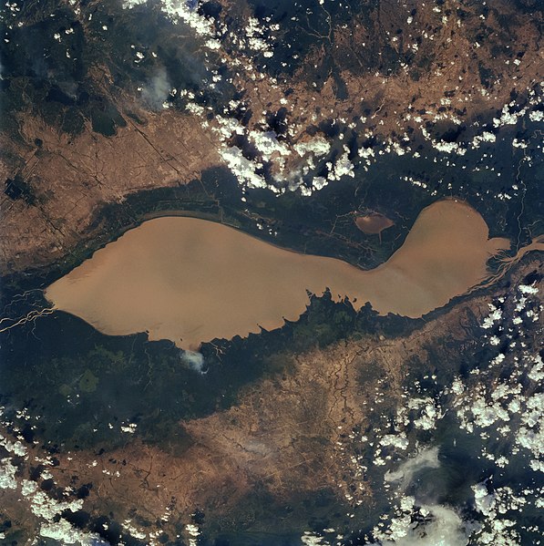
Tập tin:Tonlesap.jpg

Kích thước hình xem trước: 597×599 điểm ảnh. Độ phân giải khác: 239×240 điểm ảnh | 478×480 điểm ảnh | 765×768 điểm ảnh | 1.020×1.024 điểm ảnh | 2.039×2.048 điểm ảnh | 4.079×4.096 điểm ảnh.
Tập tin gốc (4.079×4.096 điểm ảnh, kích thước tập tin: 17,17 MB, kiểu MIME: image/jpeg)
Lịch sử tập tin
Nhấn vào ngày/giờ để xem nội dung tập tin tại thời điểm đó.
| Ngày/giờ | Hình xem trước | Kích cỡ | Thành viên | Miêu tả | |
|---|---|---|---|---|---|
| hiện tại | 10:40, ngày 4 tháng 4 năm 2022 |  | 4.079×4.096 (17,17 MB) | Tiouraren | larger version |
| 06:48, ngày 15 tháng 7 năm 2015 |  | 902×695 (293 kB) | Wikirictor | i re-sized it, enhanced its quality and rotated it in order to have north on top. | |
| 05:04, ngày 18 tháng 6 năm 2006 |  | 637×640 (53 kB) | Georgio~commonswiki | {{Information |Description=Earth Sciences and Image Analysis, NASA-Johnson Space Center. 16 Apr. 2004. "Earth from Space - Image Information." |Source=http://earth.jsc.nasa.gov/sseop/efs/photoinfo.pl?PHOTO=STS059-84-80 |Date=16 Apr. 2004. |Author=NASA |Pe |
Trang sử dụng tập tin
Có 2 trang tại Wikipedia tiếng Việt có liên kết đến tập tin (không hiển thị trang ở các dự án khác):
Sử dụng tập tin toàn cục
Những wiki sau đang sử dụng tập tin này:
- Trang sử dụng tại af.wikipedia.org
- Trang sử dụng tại ar.wikipedia.org
- Trang sử dụng tại az.wikipedia.org
- Trang sử dụng tại bg.wikipedia.org
- Trang sử dụng tại ca.wikipedia.org
- Trang sử dụng tại ceb.wikipedia.org
- Trang sử dụng tại cv.wikipedia.org
- Trang sử dụng tại cy.wikipedia.org
- Trang sử dụng tại en.wikipedia.org
- Trang sử dụng tại en.wikivoyage.org
- Trang sử dụng tại eo.wikipedia.org
- Trang sử dụng tại es.wikipedia.org
- Trang sử dụng tại eu.wikipedia.org
- Trang sử dụng tại he.wikivoyage.org
- Trang sử dụng tại id.wikipedia.org
- Trang sử dụng tại it.wikipedia.org
- Trang sử dụng tại it.wikivoyage.org
- Trang sử dụng tại ja.wikipedia.org
- Trang sử dụng tại ka.wikipedia.org
- Trang sử dụng tại ko.wikipedia.org
- Trang sử dụng tại ms.wikipedia.org
- Trang sử dụng tại my.wikipedia.org
- Trang sử dụng tại no.wikipedia.org
- Trang sử dụng tại pl.wikipedia.org
- Trang sử dụng tại ru.wikipedia.org
- Trang sử dụng tại sh.wikipedia.org
- Trang sử dụng tại sv.wikipedia.org
- Trang sử dụng tại te.wikipedia.org
- Trang sử dụng tại th.wikipedia.org
- Trang sử dụng tại tl.wikipedia.org
- Trang sử dụng tại uk.wikipedia.org
- Trang sử dụng tại ur.wikipedia.org
- Trang sử dụng tại war.wikipedia.org
- Trang sử dụng tại www.wikidata.org
- Trang sử dụng tại zh-yue.wikipedia.org
- Trang sử dụng tại zh.wikipedia.org

